
Maison Basset

Maison Basset (1819 - 1865) was a French publishing concern active through the mid to late 19th century. The firm can trace their roots to André Basset (Bassett; fl. 1768 - 1784), who starting publishing maps, prints, and books around 1768. Maison Basset, also Chez Basset, is the imprint under which the heirs of Paul-André Bassett (1759 - 1829) operated after his death. From their offices at 64 Rue St. Jacques, then 33 Rue de Seine, Paris, France, Maison Basset published the works of such prominent French cartographers and engravers as Barbie du Bocage, A. Vuillemin, J. B. Charle, V. Levasseur, Tu. Duvotenay, H. Dufor, F. E. George, and others. Their library of publications is diverse and vast, but heavily focused on medical and scientific texts, including several important atlases. The firm is closely aligned with the Chéreau family of printers and engravers, with whom they were connected with multiple, often incestuous, marriages and remarriages.
Northwest Passage - Reconciling fact, fiction, and wishful thinking.
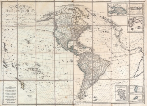
Carte de l'Amérique Septentrionale et Meridionale, ou se trouveur les Trois Voyages de Cook et Ceux de MacKenzie, Vancouver et La Perouse, Parry et Franklin, Dresée par Herisson, eleve de Bonne, ancien Ingénieuo hydrographe de la Marine.
$2,500.00
Acquire
- Digital Map Information
- Suitable for large format printing
- Full resolution TIFF file
- ICC color profile embedded
- Delivered instantly via download link
A most unusual and intriguing 1833 wall map of America by Eustache Hérisson. The map makes a number of interesting and curious claims regarding multiple possibilities for a Northwest Passage - attempting to reconcile factual discovery, with apocryphal popular legends, and outright wishful thinking. It covers the western hemisphere, focusing on North and South America, and the surrounding oceans. Full coverage extends east to include the coasts of Europe and Africa, and west as far as New Caledonia and New Hebrides. As the title suggests, tracks follow the maritime routes of important explorers, including Cook, Vancouver, La Perouse. The map also notes the overland expeditions of Mackenzie (1780) and Hearne (1772). Further north, the 1819 - 1820 discoveries of William Edward Parry, and John Franklin's 1819 Coppermine Expedition and 1823 Mackenzie River Expeditions are noted. (more details)
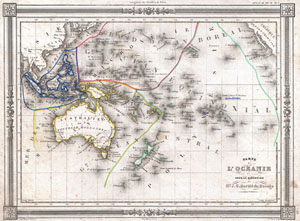
Carte de L'Oceanie dressee ET dessinee sous laDirection de Mr. J. G. Barbie du Bocage.
$150.00
Acquire
- Digital Map Information
- Suitable for large format printing
- DPI: 300
- File Size: 4.94 MB
- File Type: ZIP / TIFF
- ICC color profile embedded
- Delivered instantly via download link
An uncommon and extremely attractive 1852 map of Oceania by J. G. Barbie du Bocage. Includes Australia, New Zealand, Polynesia, Micronesia, Melanesia and Malaysia. Australia is described as 'pays inconnu' and alternately labeled 'New Holland.' Hawaii shown as ... (more details)