
Maison Basset (sold)

Maison Basset (1819 - 1865) was a French publishing concern active through the mid to late 19th century. The firm can trace their roots to André Basset (Bassett; fl. 1768 - 1784), who starting publishing maps, prints, and books around 1768. Maison Basset, also Chez Basset, is the imprint under which the heirs of Paul-André Bassett (1759 - 1829) operated after his death. From their offices at 64 Rue St. Jacques, then 33 Rue de Seine, Paris, France, Maison Basset published the works of such prominent French cartographers and engravers as Barbie du Bocage, A. Vuillemin, J. B. Charle, V. Levasseur, Tu. Duvotenay, H. Dufor, F. E. George, and others. Their library of publications is diverse and vast, but heavily focused on medical and scientific texts, including several important atlases. The firm is closely aligned with the Chéreau family of printers and engravers, with whom they were connected with multiple, often incestuous, marriages and remarriages.
Rare First Edition of a Richly Detailed Western Hemisphere Map.
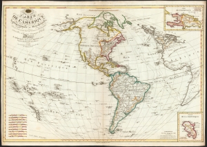
Carte de l'Amérique Septentrionale et Meridionale, ou se trouvent les Decouvertes les plus nouvelles, et les trois Voyages de Cook Dressée Par Hérisson, E lève du C.en Bonne, ancien Ingénieur Hydrographe de la Marine. A Paris, Chez Basset, rue Jacques, au coin de celle des Mathurins, No. 670.
sold
- Digital Map Information
- Suitable for large format printing
- DPI: 600
- File Size: 79.61 MB
- File Type: ZIP / TIFF
- ICC color profile embedded
- Delivered instantly via download link
This is a rare, elegant, and detailed map of America by Eustache Hérisson, in its 1795 first edition. In addition to the Western Hemisphere, Hérisson's work focuses on the three voyages of Captain James Cook - in particular, presenting the key results of his third and final journey to Hawaii, and his efforts to penetrate the Bering Straits. Cook's tracks through the Pacific and the Atlantic both are included. His journey through the South Pacific, its revelations of New Zealand, and the cipher presented by the as-yet undetected Antarctica are also made evident. (more details)
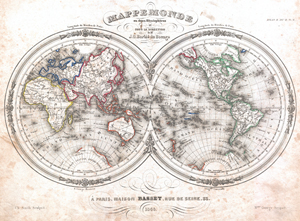
Mappemonde en deux Hemispheres.
sold
- Digital Map Information
- Suitable for large format printing
- DPI: 300
- File Size: 14.82 MB
- File Type: ZIP / TIFF
- ICC color profile embedded
- Delivered instantly via download link
An uncommon and extremely attractive 1848 map of the world in hemispheres by J. G. Barbie du Bocage. Shows U.S. claims to British Columbia. Australia is labeled 'Nouvelle Hollande' and 'inconnus.' Africa to is largely unexplored and is labeled 'pays inconnous.' ... (more details)
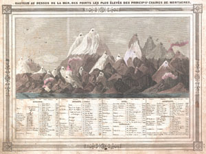
Hauteur au Dessus de la Mer, Des Points Les Plus Eleves des Principles Chaines de Montagnes.
sold
- Digital Map Information
- Suitable for large format printing
- DPI: 300
- File Size: 5.47 MB
- File Type: ZIP / TIFF
- ICC color profile embedded
- Delivered instantly via download link
An uncommon and attractive 1852 chart by J. G. Barbie du Bocage. Shows the relative elevations of the world's great mountains. Divided according to continent. Features a beautiful frame style border. Prepared by J. G. Barbie du Bocage for publication in Maison ... (more details)
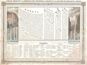
Tableau IndiquantLa Longueur des Principaux Fleuves et la Hauteur de Quelques Chutes.
sold
- Digital Map Information
- Suitable for large format printing
- Full resolution TIFF file
- ICC color profile embedded
- Delivered instantly via download link
An uncommon and attractive 1852 chart by J. G. Barbie du Bocage. Shows the relative lengths of the world's great rives and the heights of the world's great waterfalls. Divided according to continent. Features a beautiful frame style border. Prepared by J. G. ... (more details)
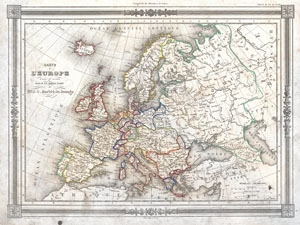
Carte de L'Europe
sold
- Digital Map Information
- Suitable for large format printing
- Full resolution TIFF file
- ICC color profile embedded
- Delivered instantly via download link
An uncommon and attractive 1852 map of Europe by J. G. Barbie du Bocage. Details all of Europe including Iceland as well as parts of Asia and Africa. Shows the Austrian Empire at its height, the many states of the German Confederacy, and a pre Garibaldi Italy ... (more details)
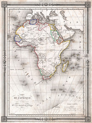
Carte de L'Afrique dressee ET dessinee sous la Direction de Mr. J. G. Barbie du Bocage.
sold
- Digital Map Information
- Suitable for large format printing
- DPI: 300
- File Size: 4.96 MB
- File Type: ZIP / TIFF
- ICC color profile embedded
- Delivered instantly via download link
An uncommon and extremely attractive 1852 map of Africa by J. G. Barbie du Bocage. Shows the continent of Africa situated high on the page. Labels the costal kingdoms and colonies including Zanzibar, Biafra, Senegabia, Algeria, Maroco, Abyssinia, Nubia, the ... (more details)
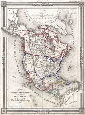
Carte de L'Amerique Septentrionale dresse ET dessinee sous laDirection de Mr. J. G. Barbie du Bocage.
sold
- Digital Map Information
- Suitable for large format printing
- DPI: 300
- File Size: 5.41 MB
- File Type: ZIP / TIFF
- ICC color profile embedded
- Delivered instantly via download link
An uncommon and extremely attractive 1852 map of North America by J. G. Barbie du Bocage. Depicts all of North America from the Arctic Circle to the northern part of South America. The United States is shown shortly after the acquisition of Texas and Upper ... (more details)
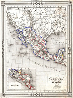
Mexique par Th. Duvotenay.
sold
- Digital Map Information
- Suitable for large format printing
- DPI: 300
- File Size: 4.93 MB
- File Type: ZIP / TIFF
- ICC color profile embedded
- Delivered instantly via download link
An uncommon and extremely attractive 1852 map of the Mexico by Th. Dovotenay. Includes all of modern day Mexico as well as Texas and the territories (Upper California) claimed by Mexico prior to the 1849 Treaty of Guadaloupe-Hildago. Shows the Mexico – ... (more details)
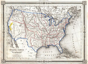
Etats-Unis par Th. Duvotenay.
sold
- Digital Map Information
- Suitable for large format printing
- DPI: 300
- File Size: 4.99 MB
- File Type: ZIP / TIFF
- ICC color profile embedded
- Delivered instantly via download link
An uncommon and extremely attractive 1852 map of the United States by Th. Dovotenay. Depicts the United States at the height of the California Gold Rush and shortly after the annexation of Texas. While most of the eastern United States is well defined the ... (more details)
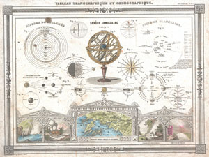
Tableau Uranographique et Cosmographique.
sold
- Digital Map Information
- Suitable for large format printing
- DPI: 300
- File Size: 3.94 MB
- File Type: ZIP / TIFF
- ICC color profile embedded
- Delivered instantly via download link
An uncommon and attractive 1852 Astronomical and Cosmographical chart by M. Vuillemin. Includes numerous charts showing the Ptolemaic planetary system, the modern planetary system, the Lunar system the seasons, directions, an armillary sphere, etc... Along ... (more details)
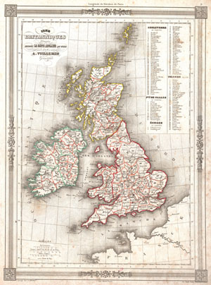
Iles Britanniques Dresees d'appres La Carte Anglaise de Wild.
sold
- Digital Map Information
- Suitable for large format printing
- DPI: 300
- File Size: 4.56 MB
- File Type: ZIP / TIFF
- ICC color profile embedded
- Delivered instantly via download link
An uncommon and attractive 1852 map of the British Isles by A. Vuillemin. Details England, Scotland and Ireland as well as parts of neighboring France. Based on an earlier map by the English mapmaker Wild. Upper right corner features a list of counties ... (more details)
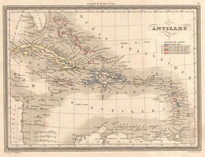
Antilles.
sold
- Digital Map Information
- Suitable for large format printing
- DPI: 300
- File Size: 5.17 MB
- File Type: ZIP / TIFF
- ICC color profile embedded
- Delivered instantly via download link
An attractive 1852 map of the Caribbean by A. Vuillemin. Details color coded colonial holdings, relief shown by hachures. Features a beautiful frame style border. Prepared by A. Vuillemin for publication as plate no. 32 in Maison Basset's 1852 edition of ... (more details)