
Matbaa-i Bahriye (ماتباايى باهريي)

Matbaa-i Bahriye (ماتباايى باهريي; c. 1887 - 1926) was the printing house of the Ministry of the Navy (Bahriye Nezareti) in the last years of the Ottoman Empire and the first years of the Republic of Turkey. It was an active publishing house, producing works related to navigation, hydrography, and naval warfare, often in translation from English and other European languages.
AKA: ماتباايى باهريي
Modernizing Ottoman maritime data.
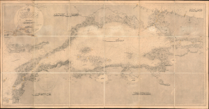
مارمارا ضنيزي / [Sea of Marmara].
$2,800.00
Acquire
- Digital Map Information
- Suitable for large format printing
- File Size: 1762.71 MB
- File Type: ZIP / TIFF
- ICC color profile embedded
- Delivered instantly via download link
A fascinating 1896 nautical chart or map of the Sea of Marmara, including the Bosphorus Straits, published by the Ottoman Matbaa-i Bahriye (Printing House of the Naval Forces). It is based on a British Admiralty chart of the same, reflecting both the advanced state of British hydrography at the time and the efforts of the late Ottoman state to close the gap with Western empires. (more details)