
Nicholson, Walter Lamb

Walter Lamb Nicholson (April 27, 1825 - April 13, 1895) was a topographer working with the United States Postal Service in the second half of the 19th century. Nicholson was born in Edinburgh, Scotland, where he trained as a civil engineer. He emigrated to the United States in 1856, registered for the draft in the American Civil War (1861 - 1865) in 1863, and naturalized as U.S. Citizen in 1873. By 1860 he was working in Washington D.C. as a lithographer with the U.S. Coast Survey, where he introduced photolithographic technology. On July 15, 1861, he transitioned to the Postal Department, where he succeeded Henry A. Burr (1809 - 1863) as official 'Topographer'. He issued numerous important postal route maps from about 1866 to his retirement in 1887. His postal maps continued to be used and updated by subsequent Postal Topographers until about 1900.
Railroads in the Eastern Theater of the American Civil War.
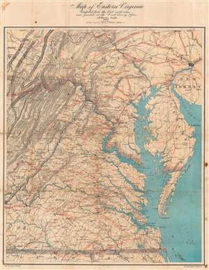
Map of Eastern Virginia.
$2,000.00
Acquire
- Digital Map Information
- Suitable for large format printing
- Full resolution TIFF file
- ICC color profile embedded
- Delivered instantly via download link
This is an 1862 Walter L. Nicholson map of eastern Virginia and Maryland, published during the second year of the American Civil War (1861 - 1865). The map embraces the Eastern Theater of war, from Pennsylvania south to the North Carolina - Virginia border. Washington, D.C. stands out on the Potomac River, while red concentric circles in ten mile increments focus upon Richmond. No battlefields are explicitly marked, but landmarks for which battles were named both before and after this map was published, including Fredericksburg, Chancellorsville, Spotsylvania Court House, and Gettysburg, appear. Red overprinting illustrates the railroad network, which proved critical to both the Union and Confederate war effort. Both sides used the railroads to move men and supplies to and from battlefields. Railroads and railroad hubs thus became strategic targets for raids and advancing armies. (more details)