
Payne, James Henry

James Henry Payne (1870 - c. 1935) was a Los Angeles-based civil engineer and cartographer who collaborated with some of the major map publishers of the era, including Rand McNally and Thomas Brothers. According to census records, Payne was born in Illinois in 1870 and appears to have begun his career as a railroad surveyor, initially for the Choctaw, Oklahoma and Gulf Railroad and then for railroads in Southern California, where he had relocated by 1907. Even when working with larger map publishers like Rand McNally, Payne's maps generally resembled survey maps, with survey lines and blue line print, giving them a distinctive style.
Mojave Mines.
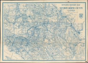
Settler's and miner's map of San Bernardino County California.
$450.00
Acquire
- Digital Map Information
- Suitable for large format printing
- File Size: 62.98 MB
- File Type: ZIP / TIFF
- ICC color profile embedded
- Delivered instantly via download link
A scarce, large-format 1932 James H. Payne map of San Bernardino County, California, published by Thomas Brothers. True to its title, it particularly highlights mines, water sources, and railroads. (more details)