
Petrini, Paolo

Paolo Petrini (c. 1670 - 1722) was an Italian bookseller, engraver, and publisher active in Naples at the turn of the 18th century. He was not primarily a cartographer, but rather a publisher and engraver, and as such his maps are cartographically derivative of Nicolas (1600 - 1667), Guillaume Sanson (1633 - 1703), Nicolas De Fer (1646 - 1720), and Giacomo Cantelli da Vignola (1643 - 1695). He issued allegorical prints (many made after Painter Luca Giordano), a handful of wall maps, and his supremely rare 1700 atlas, Atlante Partenopeo. At some point in his career in or after 1700, Petrini received an Privilege, a kind of early copyright, likely from Philip V of Spain, who was the King of Naples. After his death in 1722, the firm was taken over by his son, Michele Angelo Petrini, who reissued some of his works. Little else is known of Petrini, whose life is as obscure as his works are rare.
Italian Edition of a Seminal Map of America.
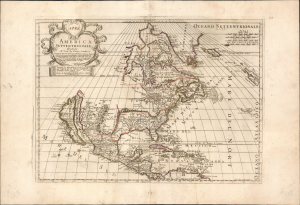
America Settentrionale.
$4,500.00
Acquire
- Digital Map Information
- Suitable for large format printing
- Full resolution TIFF file
- ICC color profile embedded
- Delivered instantly via download link
This is the rare, 1700 first state of Paolo Petrini's map of North America, produced by the Neopolitan map publisher for inclusion in his Atlante Partenopeo. It presents North America, including the Maritimes, the West Indies, and Central America. The work was derived from the authoritative cartography of the French mapmaker Nicolas Sanson, whose 1669 map of North America provided the basis for this Italian edition. (more details)
Unrecorded Proof State.
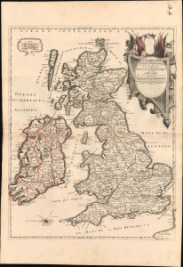
L'Inghilterra Divisa in sette Regni quarttro de Sassoni e'tre dell' Inglesi, et il Principato di Galles, ciascuno diviso ne loro Shire, overo Contadi. La Scotia Regno diviso in due parte principali, di qua'e di la del Tay, overo ne due Regni, dei Pitti, e de Scoti. L'Irlanda Regno diviso in quattro Provincie, e queste ne suoi Contadi.
$1,600.00
Acquire
- Digital Map Information
- Suitable for large format printing
- Full resolution TIFF file
- ICC color profile embedded
- Delivered instantly via download link
This is the unrecorded first state of Paolo Petrini's c. 1700 map of the British Isles, including England, Scotland, Wales, and Ireland. The engraving here is so fresh and the strike so early that the plate haze and text guidelines remain visible. (more details)
Extremely Rare Italian map of Southeast Asia.
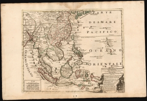
Penisola Dell Indie Orientali De La Del Gange Con Tutte l'Isole cosi Filippine della Sondaq, Ceilan, e Moluche Altre, seconde le Relationi piu moderne descritta da Nicolo De Fer.
$9,500.00
Acquire
- Digital Map Information
- Suitable for large format printing
- File Size: 26 MB
- File Type: ZIP / TIFF
- ICC color profile embedded
- Delivered instantly via download link
This is an exceptionally rare and beautifully engraved 1717 map of Southeast Asia by Neapolitan engraver Paolo Petrini, published in the composite atlas Atlante Partenopeo. Dated 1717, it presents Southeast Asia, the Philippines, and the East Indies after the cartography of the French mapmaker, Nicolas De Fer. (more details)