
Sabiston, Alexander

Alexander Sabiston (April 1859 - May 5, 1900) was a Montreal based lithographer active in the late 19th century. Sabiston was born in Liverpool, England and spent his early years as a ship's carpenter.. His firm, the Sabistion Lithographic and Publishing Company, was incorporated on 1889. The firm remained active until April 13, 1896, when it went into insolvency. The firm's assets were sold at a public auction on April 28th, 1865, most of which were acquired by one 'George Hyde', who transferred the assets to the managers of the Toronto Lithographing Company. Those gentlemen registered an Appellant Company in Montreal as the 'Montreal Lithographic Company, Ltd'. Meanwhile, in May 1869, Alexander Sabiston and his brother, likely James McLeod Sabiston (1867 - 1948) founded a new firm, the Sabiston Lithographing and Publishing Company. This created a branding conflict with the 'Montreal Lithgoraphic Company', who claimed ownership of the Sabiston name, and filed proceedings against the brothers in December 1896.
'The most perfect map of British Columbia which has thus far been placed before the Public.' - Kains
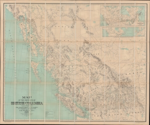
Map of the Province of British Columbia.
$3,000.00
Acquire
- Digital Map Information
- Suitable for large format printing
- File Size: 125.86 MB
- File Type: ZIP / TIFF
- ICC color profile embedded
- Delivered instantly via download link
This is Gotfred Jörgensen's rare 1895 wall map of British Columbia, the 3rd official map of the province and the best to appear in the 19th century. Jörgensen's map represents a significant advancement over earlier regional maps, offering both greater size and more up-to-date detail. Thomas Kains, Surveyor General of British Columbia, rightly described 'the most perfect map of British Columbia which has thus far been placed before the Public.' The map is significant, emerging as British Columbia, newly connected via railroads and steamship lines, was negotiating its place, both within Canada and globally. (more details)