
Serrell, John Junius

John Junius Serrell (July 3, 1815 - June 13, 1875) was a prominent surveyor, architect, and civil engineer in New York City in the mid-19th century. Born in London, England, Serrell emigrated with his family to the United States in his childhood. In 1839, he attained a clerkship with the City of New York's Finance Department, where he worked for eight years. Serrell's father, William, opened a civil engineering firm in New York, and John gained an understanding of the profession there. In 1844, he married Mary E. Syms (or Sims, 1822 - 1897), the daughter of a wealthy firearms dealer. (The couple had three sons.) The same year, he was appointed City Surveyor, a position he held for many years, during which he helped plot the city's extension into the Upper West Side, in particular. In 1866, he was appointed Consulting Engineer for Central Park, with a focus on the west side of the park, which had not been developed much at that time. An obituary described him as the 'first topographical engineer of the city' at this time. Unfortunately, at the peak of his prestige, Serrell became incapacitated by an illness. Serrell took a trip to Europe to attempt to regain his health, but to no avail, and after returning, he died in his home in Bayonne, New Jersey, and was buried in Brooklyn's Green-wood Cemetery. Serrell's long career with the city at a time when it was expanding rapidly meant that he produced many maps and surveys that would be consulted for urban planning and legal disputes for decades afterwards.
His brothers, Edward Wellman Serrell (1826 - 1906) and James E. Serrell (1820 - 1892), were also civil engineers, trained by their father and older brother John. Edward became an eminent railroad and bridge engineer and then distinguished himself during the Civil War, forming a volunteer regiment of engineers from New York (which also included James), designing Union fortifications, and building siege equipment (including a massive gun dubbed the 'Swamp Angel') during the siege of Charleston, South Carolina, becoming known after the war as 'the greatest of Civil War engineers.' James Serrell, like his brother John, was a surveyor with the City of New York, initially working with the Street Department. Like John, he had a decades-long career with the city, which included plans for sewers and for grading city streets, in addition to surveys, maps, and engineering plans.
His brothers, Edward Wellman Serrell (1826 - 1906) and James E. Serrell (1820 - 1892), were also civil engineers, trained by their father and older brother John. Edward became an eminent railroad and bridge engineer and then distinguished himself during the Civil War, forming a volunteer regiment of engineers from New York (which also included James), designing Union fortifications, and building siege equipment (including a massive gun dubbed the 'Swamp Angel') during the siege of Charleston, South Carolina, becoming known after the war as 'the greatest of Civil War engineers.' James Serrell, like his brother John, was a surveyor with the City of New York, initially working with the Street Department. Like John, he had a decades-long career with the city, which included plans for sewers and for grading city streets, in addition to surveys, maps, and engineering plans.
Roots of Riverside Park.
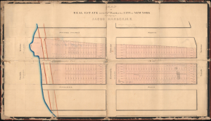
Map of Real Estate in the 12th Ward of the City of New York Belonging to Jacob Harsen, M.D.
$2,500.00
Acquire
- Digital Map Information
- Suitable for large format printing
- DPI: 600
- File Size: 60.66 MB
- File Type: ZIP / TIFF
- ICC color profile embedded
- Delivered instantly via download link
This is a 1848 John J. Serrell large-format manuscript plat map of a portion of the Upper West Side of Manhattan between 70th and 72nd Streets. The map heralds the wholesale transformation of this area in the following decades, from a collection of farms to one of the most desirable residential neighborhoods in New York City. (more details)
Some of the Most Expensive Real Estate in New York City.
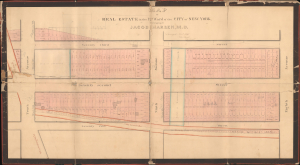
Map of Real Estate in the 12th Ward of the City of New York Belonging to Jacob Harsen, M.D.
$3,500.00
Acquire
- Digital Map Information
- Suitable for large format printing
- DPI: 600
- File Size: 60.42 MB
- File Type: ZIP / TIFF
- ICC color profile embedded
- Delivered instantly via download link
This is an 1848 John J. Serrell large-format manuscript plat map of a portion of the Upper West Side of Manhattan between 71st and 73rd Streets. Among other features, the map demonstrates the degree to which Manhattan's familiar grid pattern was misaligned with earlier properties in this portion of the island. (more details)