
Townsend, Charles Haskins
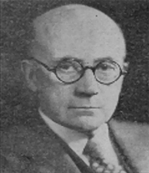
Charles Haskins Townsend (September 29, 1859 – January 28, 1944) was an American zoologist. He served as assistant United States Fish Commissioner, was in charge of deep-sea explorations on the USS Albatross, and at the turn of the century served as chief of the Fish Commission's fisheries division. From 1902 go 1937 he was director of the New York Aquarium at Castle Garden. During his career he testified as an expert at The Hague, served as president of the American Fisheries Society, and was elected a fellow of the New York Academy of Sciences. He wrote extensively on fisheries, whaling, fur seals, deep-sea exploration and zoology, including ornithology and herpetology.
Work of the USS Albatross in the Atlantic and Pacific Oceans between 1883 and 1900.
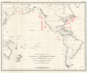
Chart Showing the Locations of the Dredgings in Less Than 100 Fathoms Made by the U.S. Fish Commission Steamship Albatross in the Atlantic and Pacific Oceans from 1883 to 1900.
$250.00
Acquire
- Digital Map Information
- Suitable for large format printing
- File Size: 20.76 MB
- File Type: ZIP / TIFF
- ICC color profile embedded
- Delivered instantly via download link
This is a 1900 C. H. Townsend and U.S. Fish Commission map of Atlantic and Pacific Ocean floor samplings less than 100 fathoms. Red numbers identify these dredging locations and can be correlated with detailed data in USS Albatross archives. Stretching from Japan to the Azores and from the Bering Sea to Cape Horn, dredgings marked were collected by the Albatross between 1883 and 1900. Unlike other maps in this series, dredging locations are marked in red but in many places dredging data is grouped geographically. Each grouping is labeled, including 'Bering Sea', 'Off Cal.', 'Off Washington' 'Off Col[ombia], and G. of Mex. And Vicinity. (more details)
The work of the USS Albatross throughout the Atlantic Ocean and eastern Caribbean Sea on her way to the Pacific.
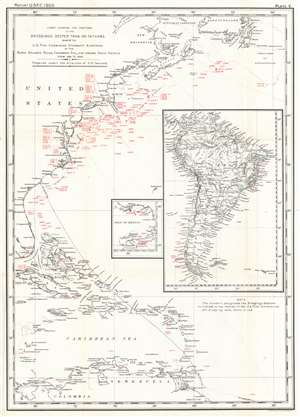
Chart Showing the Positions of the Dredgings Deeper than 100 Fathoms Made by the U.S. Fish Commission Steamship Albatross in the North Atlantic Ocean, Caribbean Sea, and around South America from 1883 to 1888.
$250.00
Acquire
- Digital Map Information
- Suitable for large format printing
- File Size: 15.67 MB
- File Type: ZIP / TIFF
- ICC color profile embedded
- Delivered instantly via download link
This is a 1900 C. H. Townsend and U.S. Fish Commission map of Atlantic Ocean Caribbean Sea floor samplings deeper than 100 fathoms. Red numbers identify these dredging locations and can be correlated with detailed data in USS Albatross archives. Stretching from Gulf of St. Lawrence south to northern South America including the Greater and Lesser Antilles and the Bahamas, dredgings marked were collected by the Albatross between 1883 and 1888. A large inset along the right border illustrates the entirety of South America and notes dredgings taken by the Albatross off the coast of Brazil and Chile. A smaller inset focuses on the Gulf of Mexico from New Orleans along the U.S. Gulf Coast to the Florida Keys and south to the Yucatan, with dredgings noted in the Gulf south of Mobile and around the Yucatan Peninsula. (more details)
Oceanographic research in the Pacific.
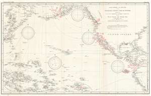
Chart Showing the Positions of the Dredgings Deeper than 100 Fathoms Made by the U.S. Fish Commission Steamship Albatross in the Pacific Ocean and Bering Sea from 1888 to 1900.
$400.00
Acquire
- Digital Map Information
- Suitable for large format printing
- File Size: 28.4 MB
- File Type: ZIP / TIFF
- ICC color profile embedded
- Delivered instantly via download link
This is a 1900 C. H. Townsend and U.S. Fish Commission map of Pacific Ocean floor samplings deeper than 100 fathoms. Red numbers identify these dredging locations and can be correlated with detailed data in USS Albatross archives. Stretching from Japan to North and South America and from the Bering Sea to Australia, Micronesia, and Polynesia, dredgings marked were collected by the Albatross between 1888 and 1900. (more details)