
Vézoue, Louis Claude de

Louis Claude de Vézoue (17?? - 1782), sometimes spelled Vezou, was a French mathematician, mapmaker, genealogist, engineer, historiographer, and astronomer active in Paris during the middle and late 18th century. In 1853 he issued an important educational wall map of the world in partnership with Jean Lattré, this was reissued c. 1760. In 1773, as historiographer to the king, he completed a detailed genealogical chart of the Kings of France.
Last Days of the Corsican Republic.
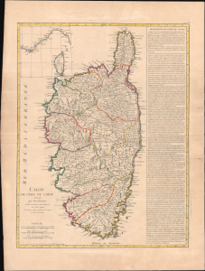
Carte de l'isle de Corse divisée par Jurisdictions.
$1,200.00
Acquire
- Digital Map Information
- Suitable for large format printing
- Full resolution TIFF file
- ICC color profile embedded
- Delivered instantly via download link
This is a c. 1768 map of Corsica published by Jean Lattré. It presents the island during the final phase of the Corsican Republic before the French invasion and occupation, which ended the republic. (more details)