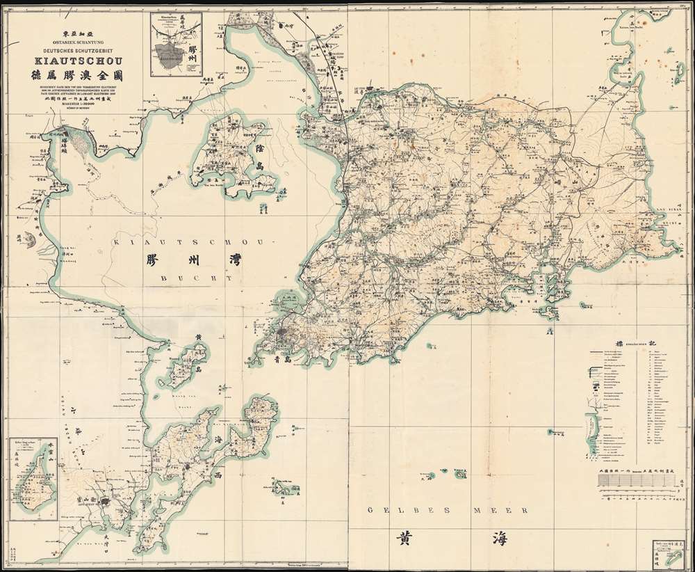
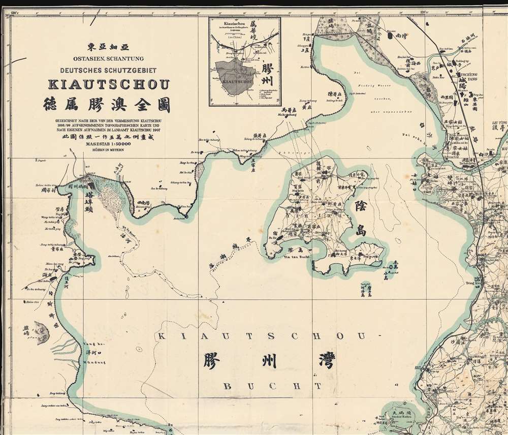
Title
Ostasien-Schantung Deutsches Schutzgebiet Kiautschou 德属膠澳全圖 gezeichnet nach der von der Vermessung Kiautschou 1898/99 augenommenen topographischen Karte und nach eigenen Aufnahmen im Landamt Kiautschou, 1907.
1907 (dated)
40.5 x 49.25 in (102.87 x 125.095 cm)
1 : 50000
Description
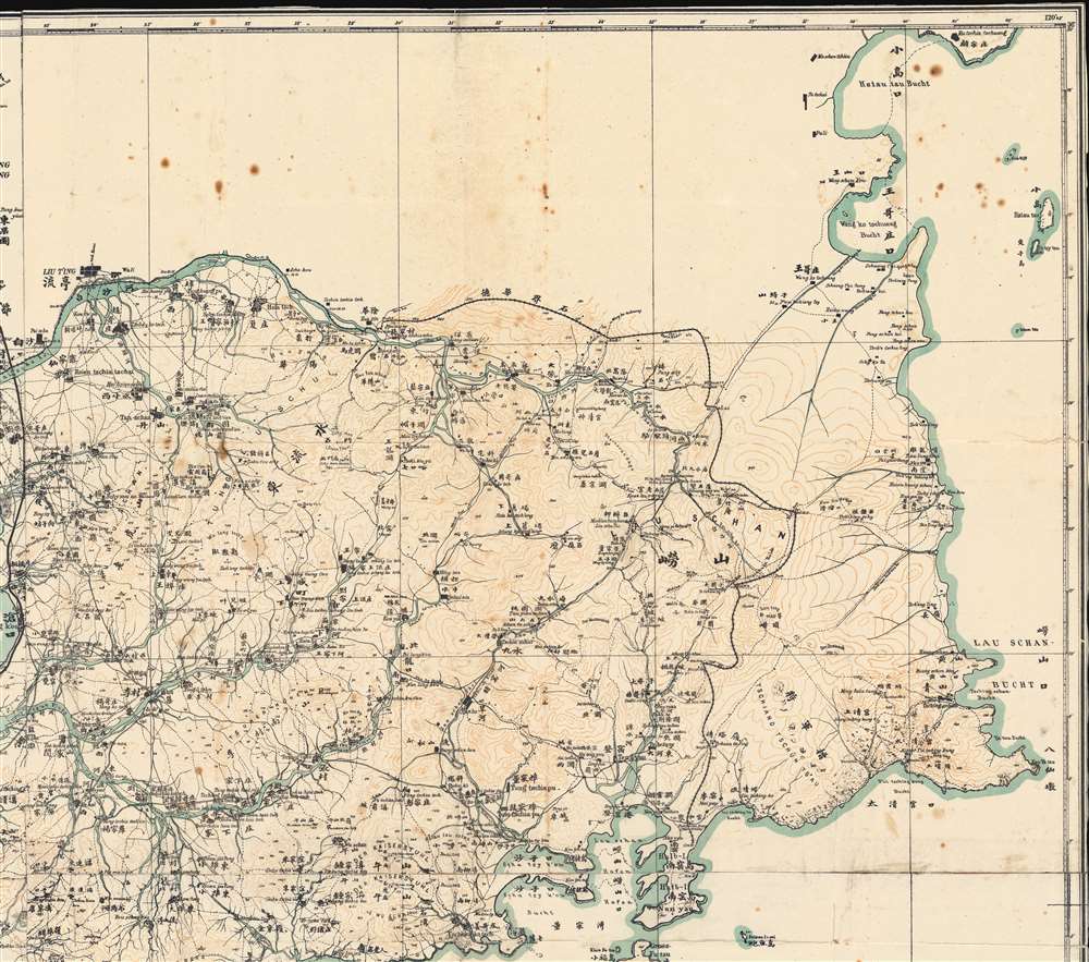
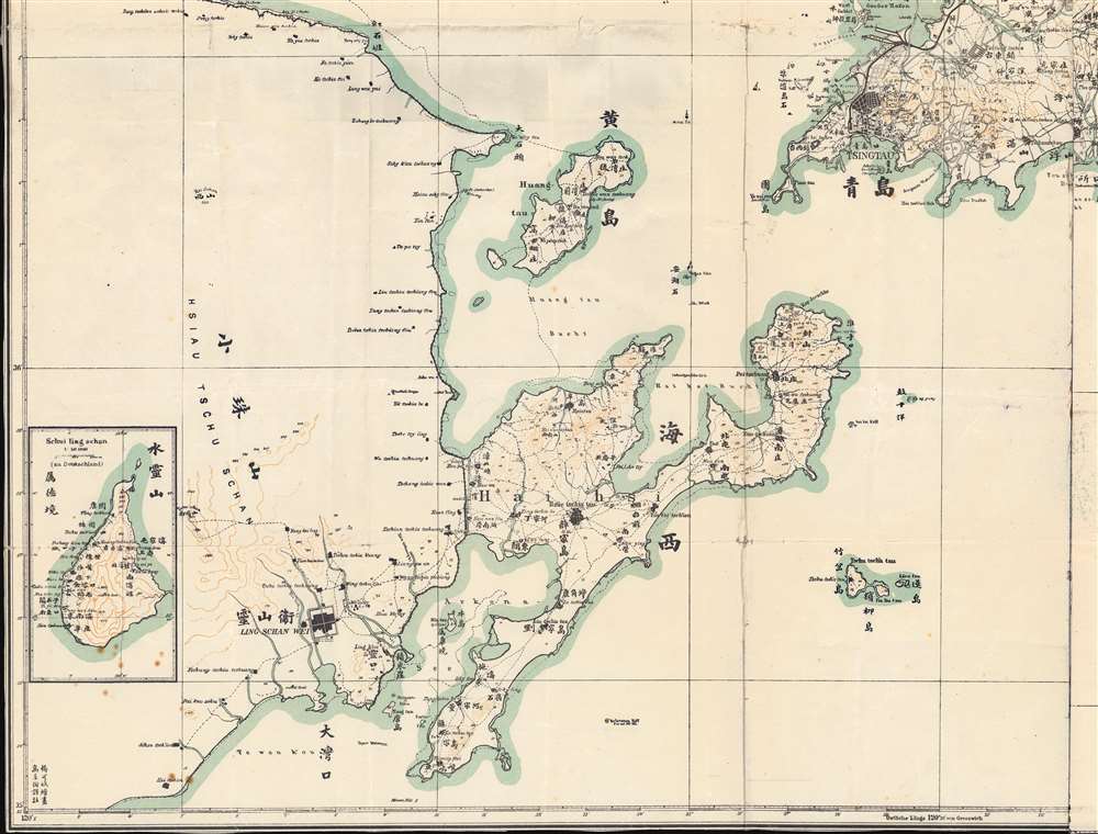
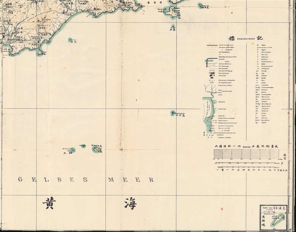
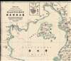
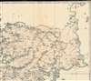
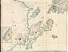
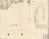
A rare and important 1907 zincographic map of Kiautschou Bay Concession, Qingdao / Tsingtau, compiled by a joint German-Chinese team led by Jacoby. This was an official map issued in Qingdao for official use. The map covers most of what is today Qingdao, Shandong, China (青岛市), embracing Jiaozhou Wan (Kiautschou Bay), and the surrounding territories. Place names appear both in English and Chinese - reflecting the fact that this map was made jointly by Jacoby and two Chinese surveyors, draughtsman Yang Kebin (杨可斌) and translator Gao Jingtao (高景陶). The city Tsingtau (meaning 'Green Island' in German) is here laid out, consisting of a German quarter to the south and a Chinese quarter (the original fishing village) to the north. The expansive harbor, constructed around the now-famous Zhanqiao Pier (青岛栈桥), was the heart of the colony, facilitating both maritime trade and German naval activity.
The Bi-Lingual Content and Use
This map was published by the Katasteramtes Kiautschou, the Land Survey Office of Kiautschou, a branch of the colonial administration that focused on land development and zoning. The fact that it is bi-lingual - uncommon in colonial maps of the period - underscores that the content was intended to be accessible by both European and Chinese readers. The map was printed in Qingdao using the fast and efficient photozincographic process. This was common in colonial offices as it did not require either great expertise or large expensive printing equipment, but was limited in that it could only produce a few copies of each map, hence this map's rarity. The use of photozincography also suggests the map was made for immediate, active use, with no time to send back to Germany for more sophisticated mass printing. Nonetheless, the map is an impressive production, being grandly proportioned and printed on four sheets, joined. It is the cumulative result of at least 3 printing passes to highlight general geography (black), topography (brown), and blue-green (water). The map was likely used for administrative reasons, to plan land use, improvements, resettlement, and property development.Kiautschou Bay Concession (1898 to 1914)
In 1890 the Qing Chinese Shandong Province city of Jiao-ao (胶澳) was little more than a fishing village. The Qing Empire, recognizing the city's potential strategic importance began fortifying the port in 1891. This work drew the attention of German naval officers who, just offshore, were completing a formal survey of Jiaozhou Bay. They too recognized the port to be strategically significant and potentially an ideal center for a German base in Asia.
German forces invaded Jiao-ao, renamed as Tsingtao / Tsingtau, in 1898, forcing the Qing to agree to the Kiautschou Bay Concession, granting Germany control over Tsingtao and the surrounding parts of Shandong. Germany had grand plans to transform the humble fishing port of Tsingtao into a model colony and major city. They lavished investment on it, constructing an ambitious street grid, planned housing areas, government buildings, electrification throughout, a sewer system, and a potable water supply. The Germans continued to administer and build Tsingtao, and were generally well thought of by the Chinese residents, until the outbreak of World War I in 1914, when Qingdao was seized by Imperial Japan.Photozincography
Photozincography, sometimes referred to as heliozincography or simply zincography (zinco), is a monochromatic reprographic process developed in the mid-19th century by Sir Henry James (1803 - 1877). The process was embraced by the British Ordnance Survey and the empire's far-flung survey offices, such as the Survey of India, due to its ability to reduce large-scale survey maps and manuscripts without costly re-engraving. The system offered an additional advantage over traditional lithography, as it used lightweight zinc printing plates instead of heavy lithographic stones. They could thus be handled and transported efficiently, making them ideal for mobile and military use. Photozincography began to decline in Europe in the 1880s, as more sophisticated printing techniques emerged, but the process remained popular in survey offices in Asia, India, and Africa until the early 20th century.Publication History and Census
This map was published in Tsingtau / Qingdao using a photozincographic process - a printing technique common in colonial offices through the early 20 century. It was drafted by one 'Jacoby', a cadastral surveyor attached to the German China Expedition (1897) and later Kiautschou Bay Concession governance. He was assisted by the Chinese draughtsman Yang Kebin (杨可斌) and translator Gao Jingtao (高景陶). It was produced for the Katasteramtes Kiautschou (Land Survey Office of Kiautschou). This map is rare. We are aware of only 2 other examples, one at Harvard, and the other at the Museum und Galerie Falkensee.
Cartographer
Jacoby (fl. c. 1897 - 1910) was a German military officer and surveyor active in Tsingtao (Qingdao), China, in the late 19th and early 20th centuries. He is identified in China Directories as a 'Katasterzeichner' or 'Cadastral Draughtsman' attached to the Tsingtao (Qingdao) colonial administration. More by this mapmaker...
Condition
Good. Minor verso repairs and reinforcements along old fold lines. Zincographic printing on 4 sheets, joined at the time of publication.
References
OCLC 913080328. Harvard Map Collection, Hollis 990144170750203941.