
Americas
One of the most decorative maps of the 18th century - here in a pristine uncolored examples.
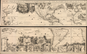
Carte très curieuse de la Mer du Sud, contenant des Remarques Nouvelles et très utiles non seulement sur des Ports et Îles de cette Mer, mais aussy sur les principaux Pays de l'Amerique tant Septentrionale que Méridionale en a été faite.
$18,000.00
Acquire
- Digital Map Information
- Suitable for large format printing
- File Size: 293.48 MB
- File Type: ZIP / TIFF
- ICC color profile embedded
- Delivered instantly via download link
One of the most spectacularly decorative maps of the 18th century, this is Henri Chatelain's magnificent 1719 map of the Americas and the Pacific. The map emerged on the cusp of a new age of global exploration wherein world-spanning trade routes offered Europeans unprecedented exposure to new cultures, peoples, and trade opportunities. It is no mistake that his map of America, as seen here, presents the continent as the center of a staggering array of trade networks reaching from Europe to America itself, the South Pacific, and Africa. (more details)
One of the most decorative maps of the 18th century.
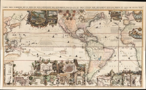
Carte très curieuse de la Mer du Sud, contenant des Remarques Nouvelles et très utiles non seulement sur des Ports et Îles de cette Mer, mais aussy sur les principaux Pays de l'Amerique tant Septentrionale que Méridionale en a été faite.
$15,500.00
Acquire
- Digital Map Information
- Suitable for large format printing
- Full resolution TIFF file
- ICC color profile embedded
- Delivered instantly via download link
One of the most spectacularly decorative maps of the 18th century, this is Henri Chatelain's magnificent 1719 map of the Americas and the Pacific. This sumptuously engraved map is centered on the American continent but extends west to include all of the Pacific as far as Beijing (Peking), China and Australia, and eastward to include much of Europe and the western half of Africa. Longitudinally it extends from the Hudson Bay to the southern tip of Tierra del Fuego. The map is graphically rich with a wealth of lush inset maps and vignette illustrations throughout. The whole is further embellished with copious annotations offering Chatelain's insights on local traditions, flora and fauna, political commentary, and notes on trade. (more details)
Grandiose Statement of British Territorial Ambition. - First Map of America to name Philadelphia.
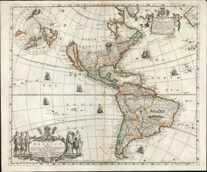
A New Mapp of America Devided According to the Best and latest Observations and Discoveries wherein are discribed by their Proper Names the seaverall Countries that Belonge to ye English which are wholly left out in all French and Dutch maps viz New Scotland, Long Iland, N. York, N. Jarsey, Mary Land, Pensilvania Carrolina etc. by Philip Lea at ye Atlas and Hercules in Cheapside and by J. Overton at the White Horse without Newgat London.
$9,500.00
Acquire
- Digital Map Information
- Suitable for large format printing
- Full resolution TIFF file
- ICC color profile embedded
- Delivered instantly via download link
This is a rare, important, separately issued 1688 English map of America, printed by Philip Lea and John Overton. It was first issued in 1684, explicitly as a rebuttal to French and Dutch maps and their representation of European spheres of influence in North America. It is the first general map of America to name Philadelphia, set in a boldly exaggerated depiction of 'The English Empire' in North America. (more details)
Spectacular 18th century wall map published during the American Revolution.
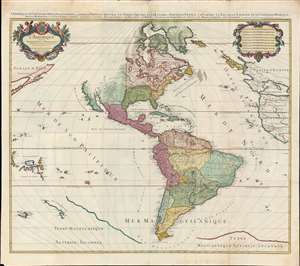
L'Amérique divisée en septentrionale et méridionale subdivisée en ses principales parties. / L'Amérique divisée en ses principales parties sçavoir dans la Septentrionale les Terres Arctiques, le Canada ou Nouvelle France, la Floride, la Nouvelle Espagne et le Nouveau Mexique ; dans la Méridionale la Terre Ferme, le Pérou, le Chili, la Terre Magellanique, le Paraguay, le Brésil. Les isles de Terre Neuve, Antilles, Magellaniques et de Californie.
$9,000.00
Acquire
- Digital Map Information
- Suitable for large format printing
- Full resolution TIFF file
- ICC color profile embedded
- Delivered instantly via download link
A spectacular 1782 wall map of North America and South America issued at the height of the American Revolutionary War, by Louis Charles Desnos, after Alexis-Hubert Jaillot. The map captures French ambitions to reclaim its American territories in the wake of the American Revolution. It also features the wealth of cartographic speculation of the era, including an unexplored Pacific Northwest and Arctic. The lower quadrants also reveal vestiges of the 16th century Terre Australis - the mythical southern continent disproven by Cook's first two voyages (His third voyage returned in 1880, but information about its discoveries had not yet been disseminated). (more details)
Earliest published sea chart focusing on the California coast!
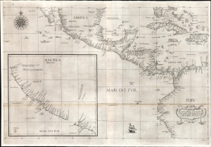
Carta prima generale d'America dell'India Occidentale e Mare del Zur.
$7,000.00
Acquire
- Digital Map Information
- Suitable for large format printing
- File Size: 26.19 MB
- File Type: ZIP / TIFF
- ICC color profile embedded
- Delivered instantly via download link
This is the 1646 first state of Robert Dudley's chart of the middle part of the Americas, illustrating the proximity of the Caribbean Sea and the Pacific Ocean and emphasizing the narrow parts of Central America dividing the two bodies of water. The chart features the western part of the Caribbean, but it is particularly noted for being the first printed sea chart to focus on the Pacific coast, including California. It is, along with Dudley's more narrowly focused charts, the first printed chart of the West Indies and South Florida to employ the Mercator Projection. An inset chart in the lower left focuses specifically on the coast of California, from Baja to Cap Mendocino. (more details)
Baroque Masterpiece in the Mapping of America.
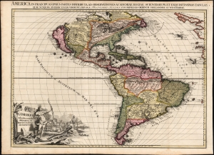
L'Amerique selon les Nouvelles Observations de Messrs. de l'Academie des Science, etc./ America in Praecipuas ipsius Partes Distributa, ad Observationes Academiae Regiae Scientiarum, et Exquisitissimas Tabulas, quae nunquam Antehac Lucem Viderunt, Excusa A Francisco Halma, Cum privilegio Ordinum Hollandiae et Westfrisiae.
$6,000.00
Acquire
- Digital Map Information
- Suitable for large format printing
- Full resolution TIFF file
- ICC color profile embedded
- Delivered instantly via download link
This is the rare first state of François Halma's c. 1699 separately-issued map of America. Its unusually large folio size, bold and sophisticated engraving, and rich original color set this map apart as one of the most beautiful late-17th-century maps of the Americas available to the collector. It dramatically presents some of the most notable geographic ideas of its era, including a prominent insular California after the Sanson model. The Great Lakes and the course of the Mississippi, as well as the rest of the American coastline, closely resembles that of Nicolas de Fer's 1699 L'Amerique. (more details)
Scarce, separately issued 'carte-á-figures' of America.

Nova Totius Americae Descriptio Auct. F. de Wit.
$5,500.00
Acquire
- Digital Map Information
- Suitable for large format printing
- Full resolution TIFF file
- ICC color profile embedded
- Delivered instantly via download link
This is Frederic De Wit's scarce, separately issued 1660 carte à figures map of America. This beautifully engraved map was one of a handful produced by De Wit to showcase his skill as he struck out on his own as a mapmaker, after having worked for many years under the Blaeu family. It represents a synthesis of traditional imagery with state-of-the-art geographical ideas. It was not intended for any particular atlas, although surviving examples occasionally appear bound into other works, including Doncker's Zee-Atlas. (more details)
Russian Interest in the Americas.
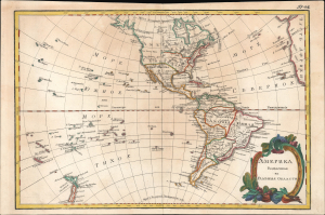
Америка раздѣленная на главныя области / [America Divided into Its Main Regions].
$2,800.00
Acquire
- Digital Map Information
- Suitable for large format printing
- File Size: 11.78 MB
- File Type: ZIP / TIFF
- ICC color profile embedded
- Delivered instantly via download link
This is a 1793 Russian-language map of the Americas produced for the 'New Atlas' (Novyy Atlas / Новый атлас), an important work that made the latest French cartography available to a Russian audience. (more details)
Enigmatic lakes in the American West.
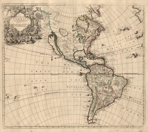
A New Map of America from the Latest Observations.
$2,500.00
Acquire
- Digital Map Information
- Suitable for large format printing
- File Size: 21.14 MB
- File Type: ZIP / TIFF
- ICC color profile embedded
- Delivered instantly via download link
This elegant English map of the Western Hemisphere, produced by John Senex in 1721, presents a fascinating glimpse of early Colonial America - increasingly detailed in the east, whilst retaining great misconceptions with regard to the western part of the continent. (more details)
Rare Early State of an Elegant, French Map of the Western Hemisphere

L'Amerique, meridionale, et septentrionale Dressée selon les Dernieres Relations et suivant les Nouvelles Decouvertes dont les pounts prin= cipaux sont placez sur les Observations de Mrs. de l'Academie Royale des Sciences.
$2,500.00
Acquire
- Digital Map Information
- Suitable for large format printing
- Full resolution TIFF file
- ICC color profile embedded
- Delivered instantly via download link
This is Nicolas de Fer's 1699 map of America, in a lovely old color example of the second state, printed in 1705. Both of the first two states of this map were separately issued, and are consequently rare. This detailed and richly annotated map, derived from De Fer's own 1698 L'Amerique Divisée Selon Letendue de set Principales Parties, shows the Americas during a period in which France was dominant in the exploration and mapping of North America. Its superb engraving is the work of Harmanus Van Loon, who also engraved De Fer's larger-scale work. (more details)
Geography for the Nation, in Greek!
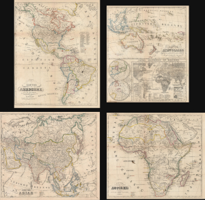
ΧAΡΤΗΣ ΤΗΣ ΑΜΕΡΙΚHΣ / ΧAΡΤΗΣ ΤΗΣ ΑΥΣΤΡΑΛIΑΣ / ΧΆΡΤΗΣ ΤΗΣ ΑΣIΑΣ / ΧAΡΤΗΣ ΤΗΣ ΑΦΡΙΚHΣ.
$2,000.00
Acquire
- Digital Map Information
- Suitable for large format printing
- File Size: 91.34 MB
- File Type: ZIP / TIFF
- ICC color profile embedded
- Delivered instantly via download link
This is an extremely rare c. 1856 set of four Greek-language educational maps published by the Athenian printer Karl Joseph Kolmann. The maps represent an early attempt by the newly independent Greece to reform and nationalize its educational system. (more details)
Americas in the Midst of Revolutions.
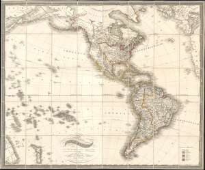
Carte de l'Amerique dressée d'après les meilleurs materiaux anglais, francais et sur les observations astronomiques de Mr. de Humboldt.
$1,800.00
Acquire
- Digital Map Information
- Suitable for large format printing
- File Size: 53.66 MB
- File Type: ZIP / TIFF
- ICC color profile embedded
- Delivered instantly via download link
This is Franz Fried's scarce 1818 folding map of the Americas, published by Artaria of Vienna. The map is significant for capturing the fast-paced political changes sweeping the continent in the wake of the Napoleonic Wars (1803 - 1815) and the breakdown of Spanish hegemony in Latin America. (more details)
Curious Late 19th Century Greek Manuscript Map.
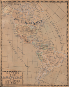
ΧΑΡΤΗΣ ΤΗΣ ΑΜΕΡΙΚΗΣ / [Map of America].
$1,800.00
Acquire
- Digital Map Information
- Suitable for large format printing
- Full resolution TIFF file
- ICC color profile embedded
- Delivered instantly via download link
An intriguing c. 1880 Greek manuscript map of the Americas produced by Sotirias Iliadou, who was possibly a schoolchild, though the level of skill and precision displayed suggests an older student. It is the only example of the 'Schoolgirl Map' genre we've identified in Greek. (more details)
An early voyage of exploration in the North Pacific.
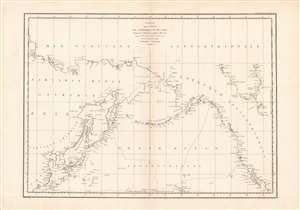
Carte des cotes de l'Amerique et de l'Asie...
$800.00
Acquire
- Digital Map Information
- Suitable for large format printing
- Full resolution TIFF file
- ICC color profile embedded
- Delivered instantly via download link
This is a wonderful example of La Perouse's important 1786 mapping of the North Pacific. When drawn in 1786 La Perouse's map was the only available map of much of this region not based on the survey work of Captain Cook. (more details)
Hopping across 'the Pond'.
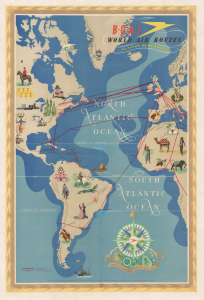
B.O.A.C. World Air Routes Western Hemisphere.
$750.00
Acquire
- Digital Map Information
- Suitable for large format printing
- Full resolution TIFF file
- ICC color profile embedded
- Delivered instantly via download link
This is a c. 1949 E. O. Seymour pictorial map of the Western Hemisphere produced for the British Overseas Air Corporation (B.O.A.C.). It was prepared during the airline's 'Golden Age,' when a Postwar commercial air travel boom was taking flight and travel between continents was becoming increasingly accessible. (more details)
The Americas in the Wake of Independence.
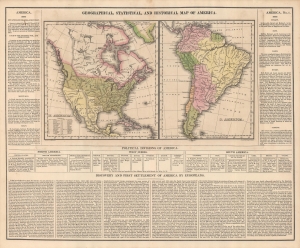
Geographical, Statistical, And Historical Map Of America.
$600.00
Acquire
- Digital Map Information
- Suitable for large format printing
- Full resolution TIFF file
- ICC color profile embedded
- Delivered instantly via download link
An informative c. 1827 map of the Americas that appeared in Matthew Carey and Isaac Lea's A Complete Historical, Chronological, And Geographical American Atlas. Among other features, it reflects territorial disputes that emerged in the wake of independence movements throughout the hemisphere. (more details)
The Yucatan at the height of the Henequen boom!
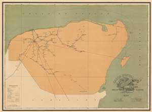
Carta Postal de la Republica Mexicana Estado de Yucatan.
$500.00
Acquire
- Digital Map Information
- Suitable for large format printing
- File Size: 26.77 MB
- File Type: ZIP / TIFF
- ICC color profile embedded
- Delivered instantly via download link
This is a 1934 General Directorate of Post and Telegraphs map of Yucatan, Mexico. The map comprises all of modern-day Yucatan as well as the adjacent modern state of Quintana Roo, including the resort cities of Playa del Carmen, Tulum, Cancun, and the resort islands of Cozumel and Isla Mujeres. The content of the map is nonetheless centered on the spiderweb of roads and tramlines extending outward from Merida - then the center of the henequen trade. Henequen, a type of agave indigenous to the Yucatan peninsula was, for nearly 100 years, the world's finest source of rope-making fiber, making Merida one of the wealthiest cities on Earth. Nonetheless, the emptiness of this map, particularly in the eastern parts, emphasizes the inhospitable nature of most of the peninsula. Around the time this map was issued, faced with competition from other fiber sources, changes in government, and inattention on the part of the hacienda owners, the henequen trade began its fast decline. But, this map is about the mail… (more details)
Defending America's Maritime Frontiers.
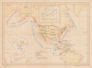
(Special COMINCH) H.O. Misc. 10,194.
$400.00
Acquire
- Digital Map Information
- Suitable for large format printing
- Full resolution TIFF file
- ICC color profile embedded
- Delivered instantly via download link
This is an unrecorded 1945 U.S. Navy Hydrographic Office map of the Americas, delineating the territory of different U.S. Navy Sea Frontiers. These zones were critical components of the U.S. war effort, securing America's coastline and shipping lanes throughout the Atlantic and Pacific Oceans. (more details)
Air Link to Latin America.
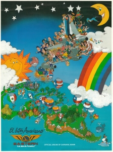
A vibrant c. 1984 promotional pictorial view of the Americas, drawn by Rubén Travieso for Eastern Air Lines to advertise their Inter-Americano Service. Aside from general promotional purposes, it was produced to highlight the airline's designation as the official Airline of Miami Carnival. (more details)
America's waterways from the era of peak canal building.
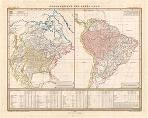
Stromgebiete der Neüen Welt.
$200.00
Acquire
- Digital Map Information
- Suitable for large format printing
- DPI: 600
- File Size: 28.94 MB
- File Type: ZIP / TIFF
- ICC color profile embedded
- Delivered instantly via download link
This is an attractive hand-colored 1849 map of the major river basins in North and South America made for Berghaus' Physikalischer Atlas, a landmark achievement in German cartography, published by Justus Perthes. As with the atlas as a whole, it shows great attention to detail and the concise presentation of scientific data. (more details)
From the North Pole to the Panama Canal.
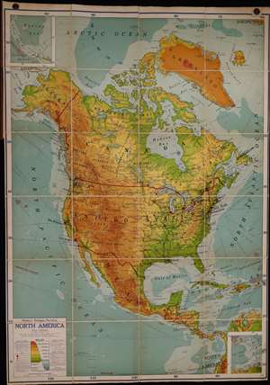
Ranally physical-political North America.
$200.00
Acquire
- Digital Map Information
- Suitable for large format printing
- File Size: 1560.55 MB
- File Type: ZIP / TIFF
- ICC color profile embedded
- Delivered instantly via download link
Here is a large-scale linen-backed folding wall map of North America produced by Rand McNally and Co. c. 1949. Both attractive and comprehensive, it combines political, topographical, and other information in a style characteristic of the 'Ranally' series produced in the mid-20th century. (more details)
Gearing Up for Total War.
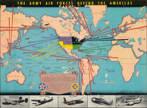
The Army Air Forces Defend the Americas.
$175.00
Acquire
- Digital Map Information
- Suitable for large format printing
- Full resolution TIFF file
- ICC color profile embedded
- Delivered instantly via download link
This is a colorful September 1941 pictorial map of the Americas, Atlantic, and Pacific that appeared in Flying and Popular Aviation magazine. It depicts the defensive arrangements of the U.S. Army Air Forces (USAAF), reflecting that the country was already largely on a war footing even before Pearl Harbor. (more details)