
City Maps - Plans - Views
A map of central Tokyo created to help orient Allied personnel during the Occupation of Japan.
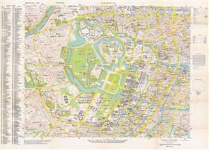
Tokyo City Plan : Marunouchi.
$1,800.00
Acquire
- Digital Map Information
- Suitable for large format printing
- File Size: 61.77 MB
- File Type: ZIP / TIFF
- ICC color profile embedded
- Delivered instantly via download link
This is a 1948 General Headquarters, Far East Command city plan or map of the Marunouchi District in central Tokyo, Japan, created for Allied (predominantly American) soldiers during the brief Allied occupation of Tokyo. This map provides an extraordinary overview of life in the city during an ephemeral period. Streets throughout the district are labeled, many of which, such as 1st Street, 10th Street, and 5th Street, were simply given names by the occupying officials who could not understand the Japanese names. Others are marked simply as Ave Y and Ave Z. Hundreds of locations are labeled by name and small circles, which identify whether that location is frequented by 'Allied Forces', 'Allied Forces and Japanese or non-Allied Forces', or 'Japanese or non-Allied Forces'. To cite only a handful of these: various motor pools, the American clubs, supply stores, and government office buildings are among these sites. Many are hotels and those billeted there, be they officers, enlisted men, women, or civilians, are identified in parentheses. Many GHQ buildings are noted, along with the headquarters of Stars and Stripes in Tokyo, the British Embassy, and the Japanese Diet Building. (more details)
Map of Mexico City published by an antiquities dealer.
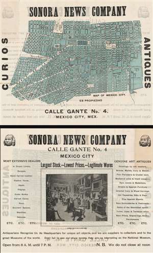
Sonora News Company. Map of Mexico City.
$375.00
Acquire
- Digital Map Information
- Suitable for large format printing
- File Size: 36.07 MB
- File Type: ZIP / TIFF
- ICC color profile embedded
- Delivered instantly via download link
This is a c. 1910 Sonora News Company city plan or map of Mexico City. Depicting the center of the city, the map notes the Palacio Nacional, Plaza de la Constitucion, Teatro Nacional, and Plaza de la Ciudadela, among others locations. Major streets are labeled, including the Paseo de la Reforma, which remains a major Mexico City thoroughfare. Two railway stations are also labeled. Curiously, even though this is an advertisement for the Sonora News Company, the locations of their stores are not labeled. A photograph of one of the Sonora News Company's antique stores in printed on the verso. (more details)
Details a provincial capital just south of the Mekong Delta.
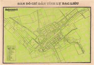
Bản Đồ Chĩ Dân Tĩnh Lỵ Bạc Liêu. / [Map Of People's Villages, Bac Lieu Province].
$250.00
Acquire
- Digital Map Information
- Suitable for large format printing
- File Size: 10.75 MB
- File Type: ZIP / TIFF
- ICC color profile embedded
- Delivered instantly via download link
This is a c. 1960 Saigon Moi Newspaper city map or plan of Bạc Liêu, Vietnam, the capital of Bạc Liêu Province. The Bạc Liêu River flows through town, and city streets are illustrated and labeled along both banks. Fourteen locations within the city are numerically identified and correspond with a key situated in the lower left corner, including the cemetery, two temples, the football field, and the hospital. During the French colonial period, Bạc Liêu was a prosperous town, with many wealthy farmers and other successful inhabitants. However, during the years of the Vietnam War, people began leaving Bạc Liêu, and the city slowly shrank, and even today is still trying to recover from the hardships suffered during the war years. (more details)
A charming city map of Manila that highlights the American embassy and United Nations Park.
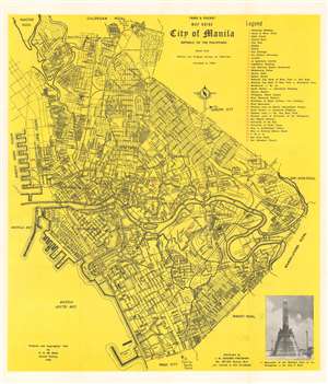
Table and Pocket Map Guide City of Manila Republic of the Philippines.
$250.00
Acquire
- Digital Map Information
- Suitable for large format printing
- File Size: 11.8 MB
- File Type: ZIP / TIFF
- ICC color profile embedded
- Delivered instantly via download link
This is a 1960 Domingo de Jesus city plan or map of Manila, Philippines. Districts are labeled throughout the city, including Intramuros, as are streets, parks, railroad stations, and universities. United Nations Park, situated near south Manila Bay, is prominently illustrated, as is the U.S. Embassy, the University of Philippines, and Philippine General Hospital. Thirty-seven locations across the city are numerically identified and correspond with an index situated in the upper right corner. A photograph of the Monument of the National Hero of the Philippines Dr. Jose P. Rizal is printed in the lower right corner. (more details)
A rare city plan or map of Vancouver created for an incredibly popular and successful department store chain.
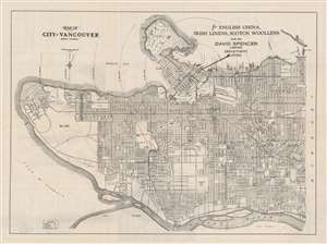
Map of City of Vancouver British Columbia.
$175.00
Acquire
- Digital Map Information
- Suitable for large format printing
- File Size: 18.23 MB
- File Type: ZIP / TIFF
- ICC color profile embedded
- Delivered instantly via download link
This is a c. 1920 David Spencer Department Store city map or plan of Vancouver, British Columbia. The map depicts the city from the University of British Columbia to Boundary Road and from First Narrows and Stanley Park to the Fraser River. A large arrow indicates the location of the David Spencer Limited Department Store, which is identified by large lettering in Vancouver Harbor. Concentric circles centered on the store emanate from here, informing the viewer of the distance in miles from the store to different parts of the city. Apart from emphasizing the location of the department store, an incredible level of detail is present. Myriad streets throughout the city are labeled and blocks along major thoroughfares are numbered. Parks, country clubs, and beaches are identified, as are several neighborhoods. (more details)