This copy is copyright protected.
Copyright © 2024 Geographicus Rare Antique Maps
1839 Monin Map of the Hebrew Peoples Dispersal After the Flood
PeoplesDispersal-monin-1839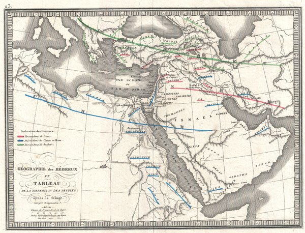

Charles V. Monin (1830 - 1880) was a French map publisher working the early to mid 19th century. A progressive printer, Monin was one of the first cartographic printers in Europe to take advantage of the newly discovered lithographic engraving process. His workshops in Paris and Caen, France, produced three important atlases as well as numerous independent issue maps. Monin was a member of La Sociéte de Géographie in Paris. He is known to have worked with other French map publishers including Vuillemin and Fremin. More by this mapmaker...
Copyright © 2024 Geographicus Rare Antique Maps | Geographicus Rare Antique Maps
This copy is copyright protected.
Copyright © 2024 Geographicus Rare Antique Maps