This copy is copyright protected.
Copyright © 2024 Geographicus Rare Antique Maps
1909 Survey Map of the Permas Rubber Estate (Bandar Baru Permas Jaya), Jahor
PermasRubberJahore-williamsdraper-1909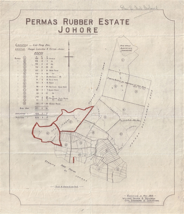

Copyright © 2024 Geographicus Rare Antique Maps | Geographicus Rare Antique Maps
This copy is copyright protected.
Copyright © 2024 Geographicus Rare Antique Maps