This copy is copyright protected.
Copyright © 2024 Geographicus Rare Antique Maps
1752 ( 1850 ) Scull & Heap Map of Philadelphia & Environs (first view of Phillidelphia State House)
Philadelphia-sculllobach-1850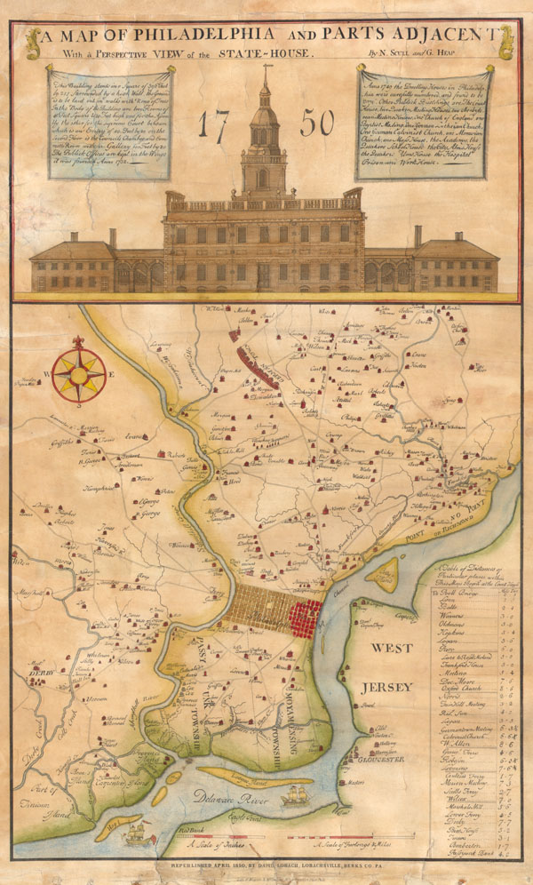

Copyright © 2024 Geographicus Rare Antique Maps | Geographicus Rare Antique Maps
This copy is copyright protected.
Copyright © 2024 Geographicus Rare Antique Maps