This item has been sold, but you can get on the Waitlist to be notified if another example becomes available, or purchase a digital scan.

1974 Carta Pictorial City Plan or Map of Tel Aviv, Israel

PictorialTelAviv-carta-1974
$100.00
Tel Aviv - Yafo. - Main View
Processing...

1974 Carta Pictorial City Plan or Map of Tel Aviv, Israel

PictorialTelAviv-carta-1974

Israel's technological and economic center.

Title


Tel Aviv - Yafo.
  1974 (dated)     23.5 x 17.5 in (59.69 x 44.45 cm)     1 : 15000

Description


This is a 1974 Carta pictorial city plan or map of Tel Aviv, Israel. Depicting the city from Tel Aviv University to Givat Aliya, streets throughout the city are illustrated and labeled. Pictorial vignettes highlight buildings around the city, including Tel Aviv University, the F. Mann Auditorium, Laski Planetarium, and Shalom Mayer Tower. Museums, libraries, cultural centers, and hotels are identified as well. Red diamond shapes mark branches of the Bank Hapoalim throughout the city. An inset highlighting the city's many bus routes occupies the upper left quadrant.
Publication History and Census
This map was created and copyrighted by Carta in 1974 and published by Bank Hapoalim. An empty OCLC reference exists for the present map, suggesting that a former cooperative member created it before withdrawing from OCLC.

Cartographer


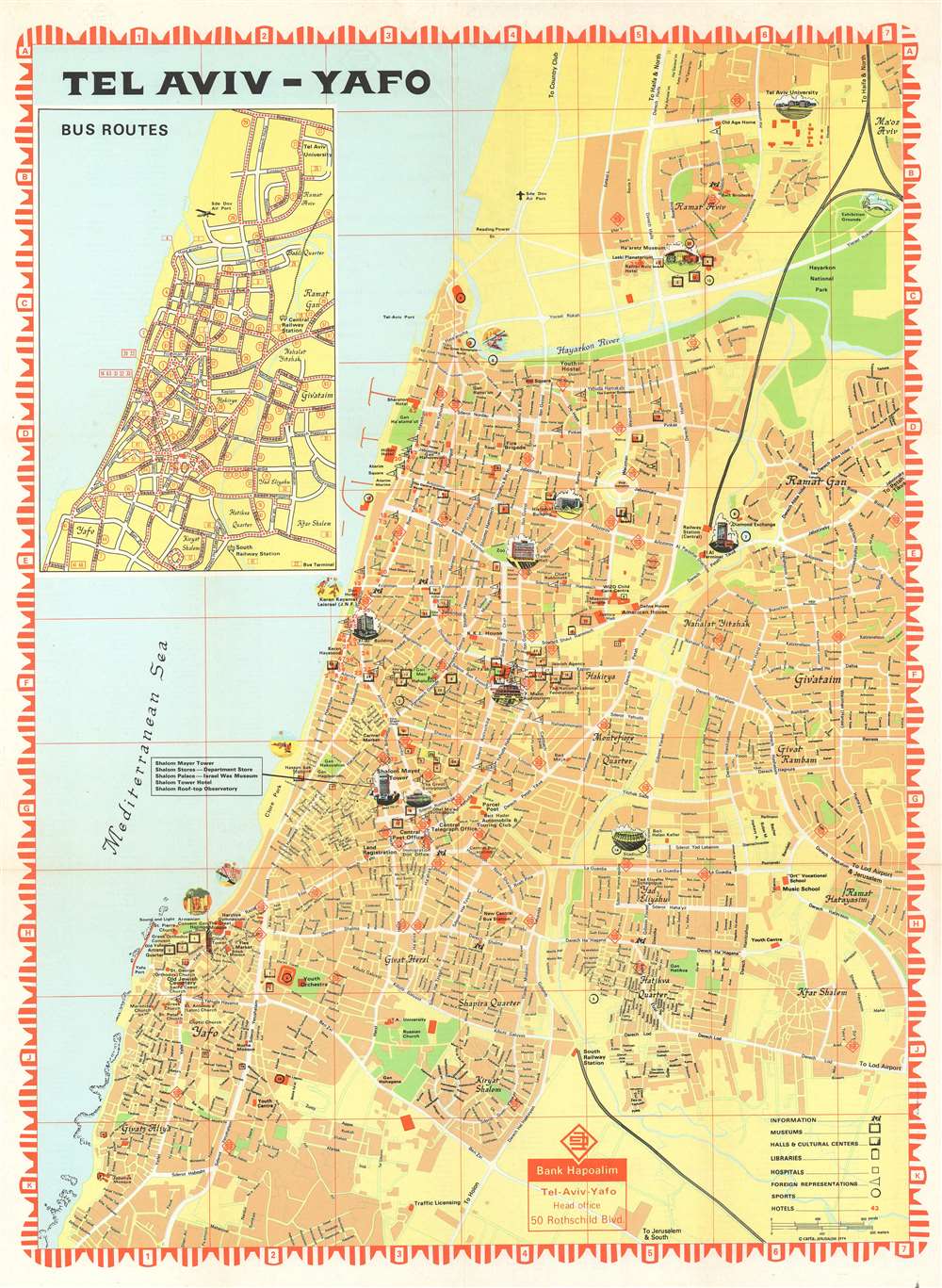
Carta (1958 - Present; כרטא) is an Israeli publisher of maps and atlases. Also known as 'Carta-Jerusalem' and 'Carta, The Israel Map and Publishing Company, Ltd.', the firm's primary focus is biblical subjects. One of the principal cartographic publishers in Israel, the firm publishes Israel's national atlas alongside motorist road maps. The firm is also known for its historical atlases, and is the licensed publisher of the Hebrew edition of the Guinness Book of World Records. More by this mapmaker...

Condition


Very good. Exhibits light wear along original fold lines. Index printed on verso.

References


OCLC 1223287973.