This item has been sold, but you can get on the Waitlist to be notified if another example becomes available, or purchase a digital scan.

1787 Wall Map of the Russian Empire

Russia-ukn-1787
$1,750.00
Nova Tabula Geographica Imperii Russici in Gubernia Divisi Edita 1787 - Main View
Processing...

1787 Wall Map of the Russian Empire

Russia-ukn-1787

A masterpiece by an mysterious unknown cartographer.

Title


Nova Tabula Geographica Imperii Russici in Gubernia Divisi Edita 1787
  1787 (dated)     33 x 71 in (83.82 x 180.34 cm)

Description


A scarce and spectacular monumentally proportioned 1787 Map of Russia by an unknown yet masterful cartographer. Renders the full sprawling extant of the Russian Empire from the Black Sea to the northwestern parts of the American Continent (Alaska) in extraordinary detail. The inland detail throughout is superb, noting cities, villages and forts as well as political distinctions, mountains, rivers and seas. Displays the river systems of Siberia and central Russia with surprising accuracy and detail. Far to the east, this map exhibits a fairly accurate rendering of Kamtschatka, Alaska and the Aleutian islands, suggesting that the cartographer had access to both the cartographic data gathered by Cook and the work of Behring and other Russian explores. Sakhalin is rendered as two separate islands, though, save for that fact, fairly accurately. The rendering of Hokkaido, though incomplete, is also somewhat accurate. There are extensive explorer's annotations along the Arctic shores of Russia.

A large decorative title cartouche at the top center, roughly at the North Pole, depicts a torch bearing woman in a Hellenic style white robe. She illuminates a globe and three cherubs, two of which are working on geographic texts while the third supports a large banner bearing the title. Two further decorative engravings decorate the extreme lower right and lower left hand corners of the map. The engraving in lower left hand corner of the map consists of a monumental obelisk supporting the armorial crests of Russia's most important cities, including Moscow, Kiev and Riga. In the lower right hand corner a gigantic broken Doric column provides the backdrop for a classically garbed woman holding a flag displaying the Imperial Russian Double Eagle in one hand and a map in the other. She gazes to her right as the Greek god Hermes, reclining upon a cloud, reaches for the flag she holds. Cannons, armor, and other military paraphernalia lie scattered about in the foreground and sailing ships ply the seas in the background.

All in all, the staggering scope and detail of this map can bear almost limitless study and examination. We have been able to identify only three other examples of this map, at Harvard University, McMaster University Library, and in the British Museum. A rare, once in a lifetime find.

Cartographer


404 Not Found

Server Error

404

Page Not Found

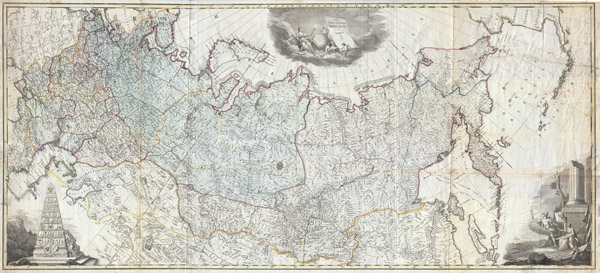
This page either doesn't exist, or it moved somewhere else.


That's what you can do

More by this mapmaker...

Source


Independent Issue.    

Condition


Very good condition. This map has been submitted to full professional flattening and restoration. It has been backed with linen for stability. The photo above is pre-restoration, so the map is now actually in a considerably better condition than the photo suggests. One large repaired tear upper right quadrant.

References


British Museum Catalogue of Printed Maps, Charts and Plans vol. 12, p. 472. McMaster Libraries, 9206. Catalogue of the Maps and Charts in the Library of Harvard University, p. 23.