This copy is copyright protected.
Copyright © 2024 Geographicus Rare Antique Maps
1848 Japanese Map of the World in Two Hemispheres
World-shincho-1848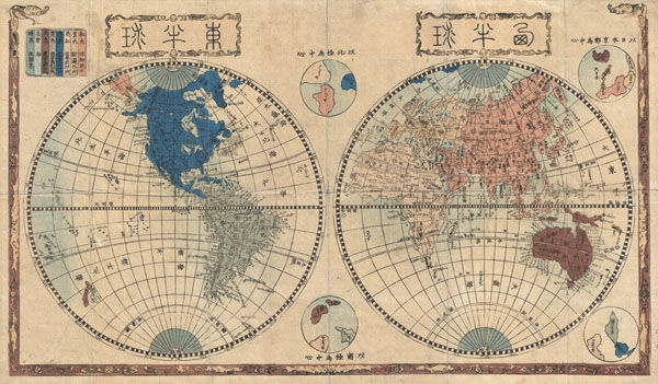

Copyright © 2024 Geographicus Rare Antique Maps | Geographicus Rare Antique Maps
This copy is copyright protected.
Copyright © 2024 Geographicus Rare Antique Maps