This copy is copyright protected.
Copyright © 2024 Geographicus Rare Antique Maps
1846 Weiland and Kiepert Map of southwestern Africa
NederGuinea-weiland-1846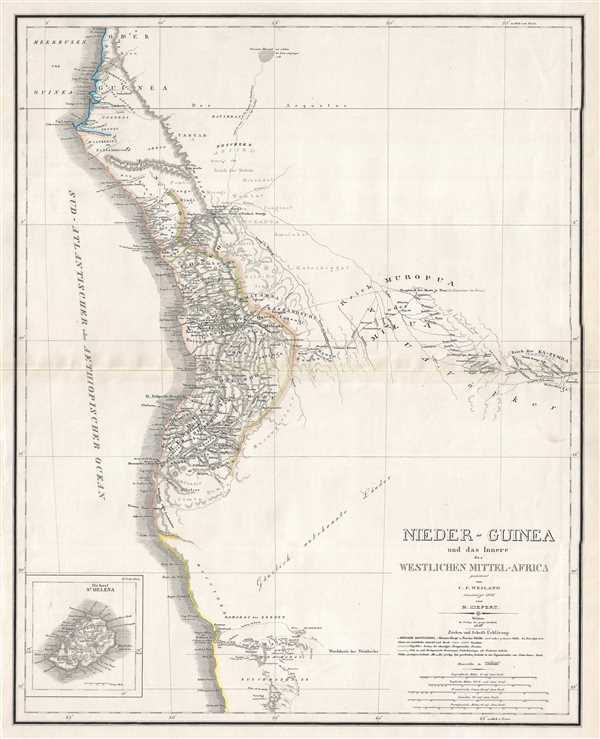

Carl Ferdinand Weiland (1782 - 1847) was a German cartographer active with the Weimar Geographisches Institut, where he headed up map and globe production, in early and middle part of the 19th century. Weiland was a trained as a military cartographer who, with his career at the Geographisches Institut, move into the private market. Among his other work, Weiland issued a German edition of Carey and Lea's American Atlas. Their edition, which was fully re-engraved in Germany, is of superior workmanship and stands out as some of the finest 19th century maps of individual U.S. states printed outside of America.Carl Ferdinand Weiland (1782 - 1847) was a German cartographer active with the Weimar Geographisches Institut, where he headed up map and globe production, in early and middle part of the 19th century. Weiland was a trained as a military cartographer who, with his career at the Geographisches Institut, move into the private market. Among his other work, Weiland issued a German edition of Carey and Lea's American Atlas. Their edition, which was fully re-engraved in Germany, is of superior workmanship and stands out as some of the finest 19th century maps of individual U.S. states printed outside of America. More by this mapmaker...
Heinrich Kiepert (July 31, 1818 - April 21, 1899) was a German cartographer and historian active in the mid to late 19th century. Kiepert was born into generous circumstances that allowed him to develop his childhood interest in geography and history into a serious profession. The Berlin-born Kiepert traveled widely in his youth, and was encouraged in his studies by the historian Leopold von Ranke, a family friend. He was a student of classical antiquity under August Meineke and worked with Cal Ritter. He studied history, philology, and geography at the Humboldt University of Berlin - he would eventually teach geography there, and would remain there until his death. Disappointed with the poor quality of maps in historical school books, Kiepert set out to correct the problem. His first major work, the Atlas von Hellas und den hellenischen Kolonien, was published with Karl Ritter in 1840. The work immediately won accolades from the academic community. A number of similar publications followed, including the 1848 Historisch-geographischer Atlas der alten Welt, the 1854 Atlas Antiquus, and the 1894 Formae Orbis Antiqui. Kiepert specialized in the historical geography of the classical world at the University of Berlin. This developed into a geographical interest in the Ottoman Empire - which at the time was poorly mapped. He traveled to Asia Minor four times between 1841 and 1848, using his travels to collect and compile geographical data, producing several outstanding regional maps with wide-ranging coverage extending from the Mediterranean to the Caucasus. Thanks in large part to these works, Kiepert became the recognized expert on Ottoman geography, his works representing the best obtainable reconnaissances of their respective regions. From 1845 until 1852, Kiepert served as the head of the Geographisches Institut in Weimar. In 1854 he took a position as professor of Geography at the University of Berlin and for nearly 50 years was considered the go-to man with regard to the cartography of classical and biblical antiquity. Kipert formed a long-lasting professional association with Dietrich Reimer, a publisher in Berlin. Kiepert's maps are known for b being clear, easy to read, and as accurate as possible for the time in which they were produced. In addition to his landmark work in mapping the Ottoman Empire, Kiepert also published the first detailed ethnic maps of Austria-Hungary, the Balkan Peninsula, and Germany. Kiepert died in Berlin on April 21 of 1899. Learn More...
Copyright © 2024 Geographicus Rare Antique Maps | Geographicus Rare Antique Maps
This copy is copyright protected.
Copyright © 2024 Geographicus Rare Antique Maps