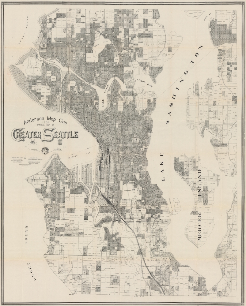
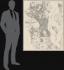
An impressive, very large, and intricately detailed map of Seattle, produced in 1909 by the Anderson Map Company to coincide with the Alaska-Yukon-Pacific Exposition. It provides a snapshot of the city in the wake of the Klondike Gold Rush, a consequent population boom, and ambitious urban planning projects.
A Closer Look
Coverage takes in most of present-day Seattle, from roughly N. 100th St. south along the Duwamish River to the area around today's King County International Airport (Boeing Field). Despite taking in such a large distance, the map is so detailed that the individual owners of larger land plots are noted, while denser city blocks are numbered and named where applicable (as with housing developments). Streets, waterways, public institutions, parks, military facilities, cemeteries, and more are listed throughout. Much of the city's south side is undeveloped and dominated by rail lines belonging to private companies. In the years following this map's publication, the city moved to gain ownership and control over the lines, greatly rationalizing their operation and opening up land for aviation in later decades.Ambitious Public Works
The 'Government Canal' seen here is the Fremont and Montlake Cuts, which today, along with the later Chittenden (or Ballard) Locks (at Salmon Bay Waterway), link Lake Washington and Lake Union with the Pacific Ocean, a project long discussed and debated but uncompleted at the time of publication. The ultimate realization of the waterways in the following years was due in large part to the guiding hand of City Engineer Reginald H. Thomson, who also championed other public works projects that completely reshaped the city, including straightening and deepening the Duwamish River, a modern sewage and electrical system, and leveling (regrading) of some of the city's larger hills and using the excavated dirt as landfill for seawalls, islands, and expanded waterfront districts. Alaska-Yukon-Pacific Exposition
A seal below the title indicates that the map was produced in tandem with the Alaska-Yukon-Pacific Exposition, a celebration of the city's revival after the great fire of 1889 and rapid growth during the Klondike Gold Rush. The exposition grounds appear at center towards top. After the exposition, this land was turned over to the neighboring University of Washington (here as 'State University') and today forms the core of its campus.Publication History and Census
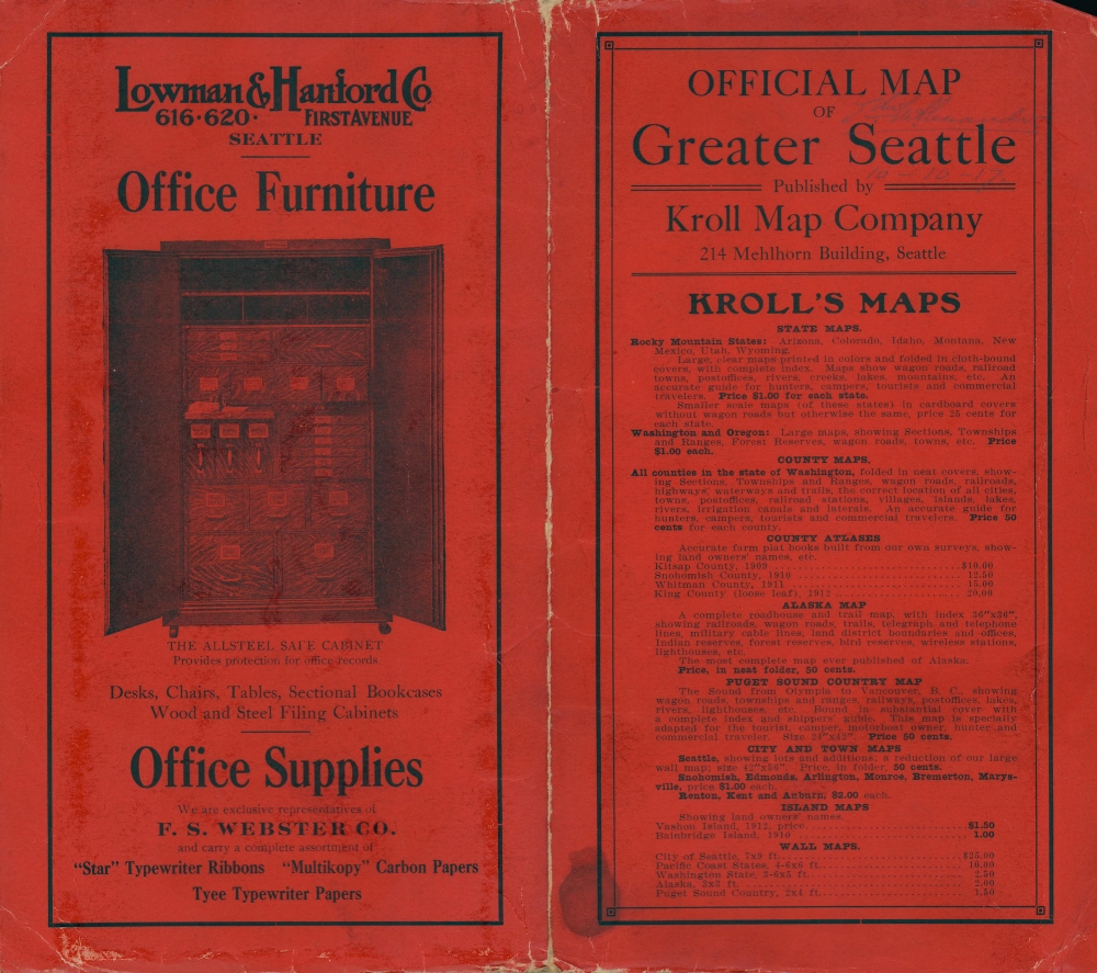
This map was prepared by Walter G. Firguson and D.M. Watters of the (O.P.) Anderson Map Company (the cover includes advertising for the Kroll Map Company, which would acquire Anderson only two years later). It is quite scarce, only being held by the Seattle Public Library, the Museum of History and Industry, and the University of California Davis.
Cartographer
Oliver Phelps Anderson (August 1859 – April 15, 1941) was a Seattle based photographer, draughtsman, businessman, and cartographer active from the latter part of the 19th century into the early 20th century. Anderson was born in Lexington, Illinois, the son of Alexander J. Anderson (1833 - 1903), a college professor. From 1882, Anderson was married to novelist Ada Woodruff Anderson (1860 - 1956) of San Francisco on June 4 of 1882. By the late 1880s Anderson had started his own business as a draughtsman. He opened a civil engineering and map publishing business, O. P. Anderson and Company around 1890. In this capacity he published several maps with W. H. Whitney (a somewhat mysterious figure) for the Northern Pacific Railroad. In addition to his work as a draughtsman and mapmaker, Anderson was a lifelong hobbyist photographer. As a hobbyist photographer and professional draughtsman Anderson was experienced with early cyanotype processes and quickly realized their potential for cartography. He released many of his maps in blueprint to facilitate rapid annotation and corrections before sending them to out for printing. Anderson's use of cyanotype photography to produce prototypes of his maps is, as far as we know, unique. Most of his map focus on the Seattle area, and King County, but some few also detail Alaska and the Yukon Gold Fields. Embracing his hobby, he opened a photography supply house, the Anderson Supply Company, located at 111 Cherry Street, Seattle, around 1900. Around 1913, Anderson’s son Maurice P. Anderson took over as president of the company, and Anderson acted as secretary-manager, a position he continued to hold until around 1940, probably until his death. Anderson Supply Co. continued to do business, with Maurice Anderson as president, until the late 1950s. Anderson's surviving hobbyist photographs are an important records of Seattle's development correspondent during its most meteoric period of growth in the late 19th century. Today many of Anderson's photographs are archived at the Sophie Frye Bass Library. More by this mapmaker...
Very good. Light wear and soiling along fold lines. Slight wear at fold intersections reinforced on verso.
OCLC 232360312. The Museum of History and Industry 1969.4750.1. Seattle Public Library SEAMAP G4284.S4 G46 1909 .F5.