This copy is copyright protected.
Copyright © 2024 Geographicus Rare Antique Maps
1948 Perceval Map of the World and Air Mail Routes
AirFrancePostal-perceval-1948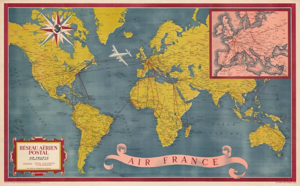


Copyright © 2024 Geographicus Rare Antique Maps | Geographicus Rare Antique Maps
This copy is copyright protected.
Copyright © 2024 Geographicus Rare Antique Maps