This copy is copyright protected.
Copyright © 2024 Geographicus Rare Antique Maps
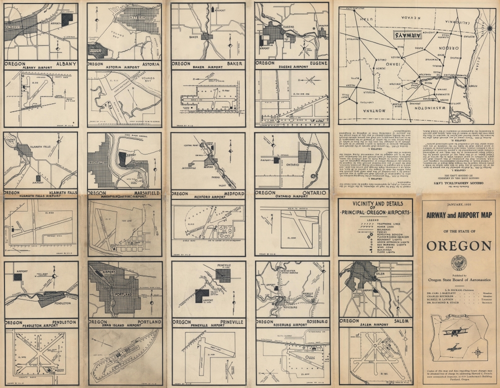
1935 Oregon State Board of Aeronautics Airways and Airport Map of Oregon
AirwayAirportOregon-aeronautics-1935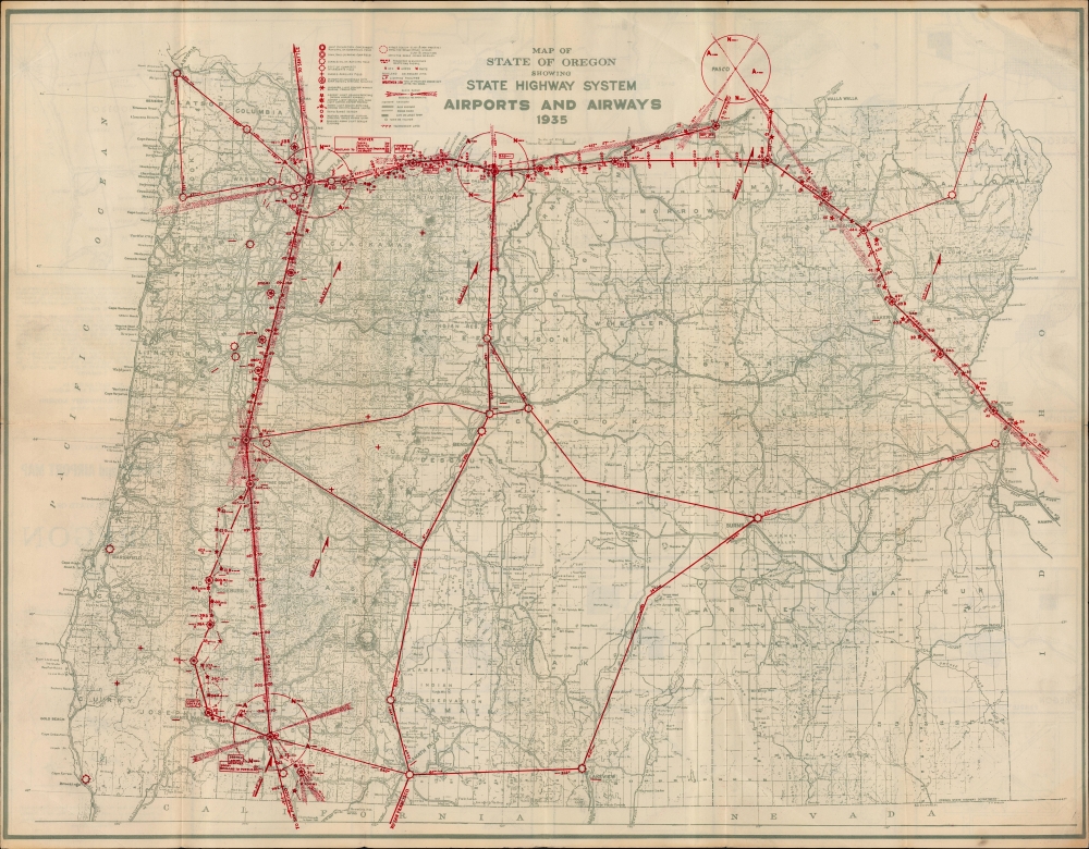

Copyright © 2024 Geographicus Rare Antique Maps | Geographicus Rare Antique Maps
This copy is copyright protected.
Copyright © 2024 Geographicus Rare Antique Maps