This copy is copyright protected.
Copyright © 2024 Geographicus Rare Antique Maps
1949 New Zealand Lands and Survey Department Map of Auckland, New Zealand
Auckland-surveylands-1949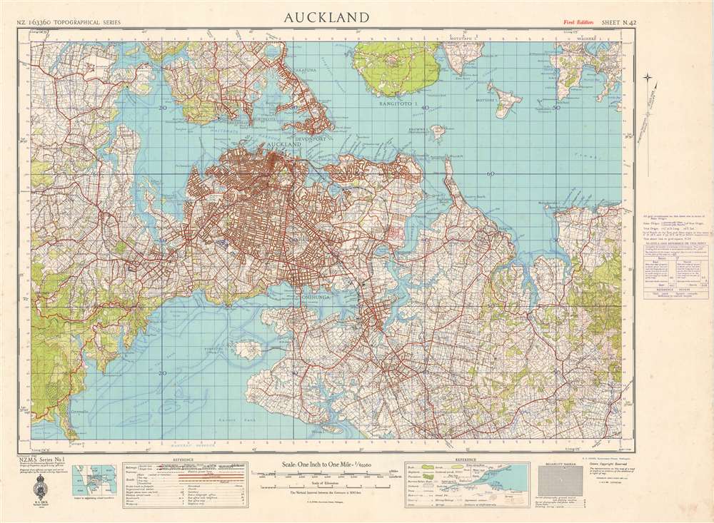

The Department of Lands and Survey (1876 - 1987) was a department of the Government of New Zealand. Formed in 1876, the Department of Lands and Survey originally had a wide range of responsibilities, such as surveying, Crown lands, roads, health and tourist resorts, and immigration. In 1886, the department was made responsible for forests and agriculture as well. Over the ensuing century, many of the departments responsibilities were tasked to other departments. By the 1980s, this distribution of activities left Lands and Survey with the core responsibilities of surveying, mapping, land development, Crown lands, and lands and deeds. The entire department was restructured in 1987 and formed the Department of Survey and Land Information, which was tasked with providing civil, government, and military survey, mapping, and land information services. A state-owned company became responsible for land development and other new departments were tasked with conservation management. Further restructuring in July 1996 led to the creation of Land Information New Zealand, a department in charge of government land-related regulatory and purchase functions. A government-owned company, Terraling NZ Ltd, was given the former department's commercial activities. That company has since gone private and been renamed Terralink International. More by this mapmaker...
Copyright © 2024 Geographicus Rare Antique Maps | Geographicus Rare Antique Maps
This copy is copyright protected.
Copyright © 2024 Geographicus Rare Antique Maps