Title
General Chart of the Coasts of Brazil, and c. From the River para to Buenos-Ayres; with Particular Plans of the Harbours.
1842 (dated)
39.25 x 77.75 in (99.695 x 197.485 cm)
1 : 2500000
Description
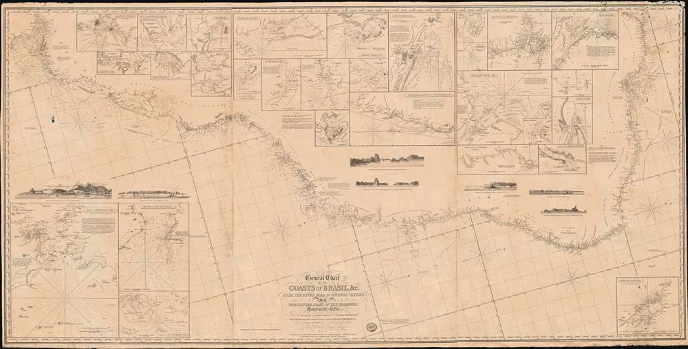
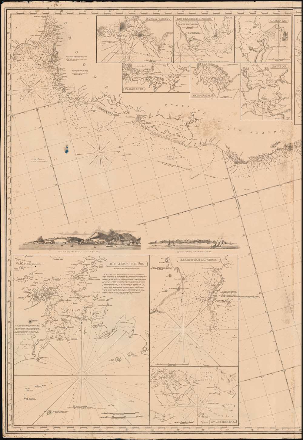
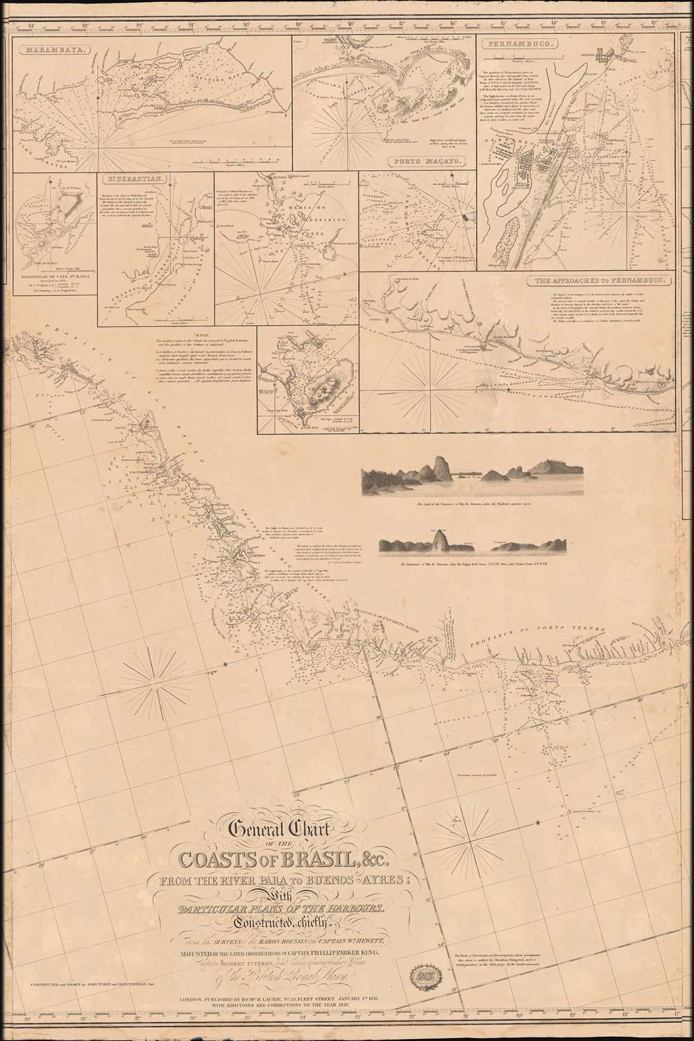
A dramatic large-scale 1842 blueback nautical chart or maritime map of Brazil by Richard Holmes Laurie - considered the best and largest general chart of Brazil produced in the 19th century. The map follows the Atlantic Coast of South America from the Para River to Buenos Ayres and the Rio de la Plata.
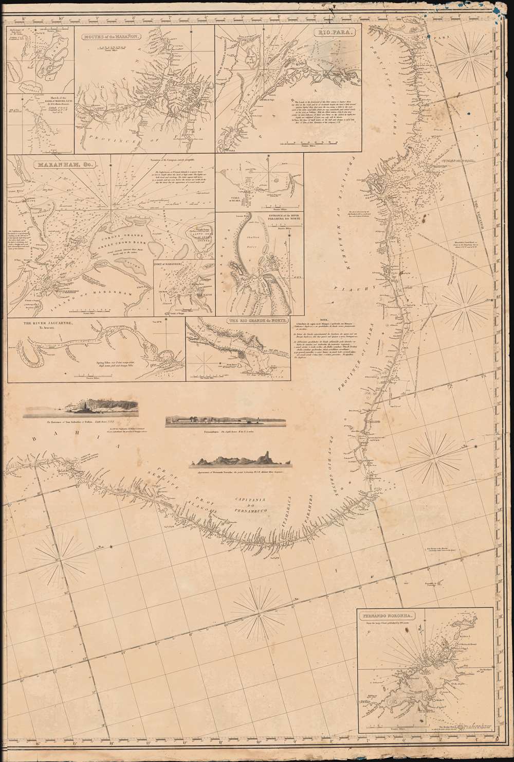
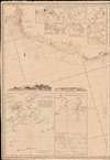
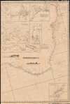
The Insets
There are seven coastal views, most notably fine city vies of Rio de Janeiro and San Salvador. As well, there are an impressive thirty-one inset maps, from clockwise: 1. Monte Video, 2. Paranagua, 3. Rio Grande de S. Pedro, 4. Maldonado, 5. Cananea, 6. Santos, 7. Marambaya, 8. Roadstead of Cape Sta. Maria, 9. St. Sebastian. 10. Bahia Do Espirito Santo, 11. Port Frio, 12. Porto Macayo, 13. Abrolhos Channel, 14. Pernambuco, 15. The Approaches to Pernambuco, 16. Anchorage of San Joao or St. John, 17. Sketch of the Bank of Manoel Luis, 18. Mouths of the Maranon, 19. Maranham, etc., 20. Port of Maranham, 21. The River Jaguarybe, To Aracati, 22. Rio Para, 23. City of Para and vicinity, 24. The Eastern Entrances Of The Rio Para, 25. Ciara or Seara, 26. Entrance of the River Parahyba Do Norte, 27. The Rio Grande do Norte, 28. Fernando Noronha, 29. St. Catharina, 30. Bahia or San Salvador, 31. Rio Janeiro. Blueback Charts
Blueback nautical charts began appearing in London in the late 18th century. Bluebacks, as they came to be called, were privately published large format nautical charts known for their distinctive blue paper backing. The backing, a commonly available blue manila paper traditionally used by publishers to wrap unbound pamphlets, was adopted as a practical way to reinforce the low-quality paper used by private chart publishers in an effort to cut costs. That being said, not all blueback charts are literally backed with blue paper. The earliest known blueback charts include a 1760 chart issued by Mount and Page, and a 1787 chart issued by Robert Sayer. The tradition took off in the early 19th century, when British publishers like John Hamilton Moore, Robert Blachford, James Imray, William Heather, John William Norie, Charles Wilson, David Steel, R. H. Laurie, and John Hobbs, among others, rose to dominate the chart trade. Bluebacks became so popular that the convention was embraced by chartmakers outside of England, including Americans Edmund March Blunt and George Eldridge, as well as Scandinavian, French, German, Russian, and Spanish chartmakers. Blueback charts remained popular until the late 19th century, when government subsidized organizations like the British Admiralty Hydrographic Office and the United States Coast Survey, began issuing their own superior charts on high quality paper that did not require reinforcement.Publication History and Census
This map was drawn by John Purdy and engraved by Alexander Findlay for Richard Holmes Laurie. It was first published on January 1, 1838, with the present example being the second edition, published in 1842. The map is based on unique survey work by Baron Albin-Reine Roussin (1781 - 1854), William Nathan Wrighte Hewett (1834 - 1888), Philip Parker King (1793 - 1856), and Robert Fitzroy (1805 - 1865). Later editions followed in 1853, 1861, 1870, and so on.
Scarce. We note one example of the 1853 edition at the David Rumsey Collection. Other examples seem to follow a major retooling in the late 19th century.
CartographerS
Richard Holmes Laurie (December 2, 1777 - January 19, 1858) was a British map and chart publisher and seller. Born in London to publisher Robert Laurie and his wife Esther Jouret, R. H. Laurie took over his father's share of the Laurie and Whittle publishing firm upon his father's retirement in 1812 and began trading as Whittle and Laurie. After Whittle died in 1818, Laurie continued the business by himself, trading under the imprint R. H. Laurie. During the 1820s and 1830s, Laurie expanded the nautical chart business until he was overtaken by Admiralty charts. Laurie married Susan Ann Coates on February 6, 1814 and later married Mary Ann Dennison on October 15, 1833. He left his business and all his property in trust for his two surviving daughters (both of whom were minors) with his principal engraver, Alexander George Findlay. Findlay continued the business in Laurie's name after acquiring its equity from his daughters. More by this mapmaker...
John Purdy (August 14, 1773- January 29, 1843) was a British cartographer and hydrographer active London during the early part of the 19th century. Purdy was born in Norwich, the son of a tailor, and apprenticed to David Steel of the Stationers Guild on December 1 of 1795. After his apprenticeship Purdy partnered with Henry Cooper to establisher an independent map and chart selling business. This business failed to turn a profit and was dissolved with bankruptcy hearings in November of 1811. From about 1812 onwards Purdy took over Delarochette's hydrographer position for the firm of Laurie and Whittle. The remainder of his work is associated with this firm. Like most map publishers Purdy did not personally take part in expeditions, but he exhibits a great talent for synthesizing the work of others. Among his more important accomplishments are the great Cabotia map of Canada, the identification of Rennell's Current, and the publication of Rennell's wind charts. He was considered the foremost British hydrographer of his era. Purdy died of gangrene on January 29 of 1843. Learn More...
Alexander George Findlay (January 6, 1812 - May 3, 1875) was an English geographer and hydrographer active in London during the middle part of the 19th century. Findlay was born in London to the Findlays of Arbroath, Forfarshire, a family long associated with nautical trades. Findlay's father, Alexander Findlay (apprentice to John Russell) was one of the original fellows of the Royal Geographical Society. The son, Alexander George Findlay, devoted himself to the compilation of geographical and hydrographical works, publishing various nautical works as well as historical atlases. In 1844 he was elected a fellow of the Royal Geographical Society. Most of Findlay's early nautical work was completed in association with the London geographical and print publishing firm of Laurie and Whittle. Following the 1858 death of Richard Holmes Laurie, Findlay took over the business, republishing many updated versions of established charts well into the late 19th century. Learn More...
Condition
Good. Working nautical chart. Exhibits edge wear, toning, some soiling, light dampstaining and foxing. Verso repairs, some older, to a couple of minor closed tears along edges.
References
Rumsey 5493.000 (1853).