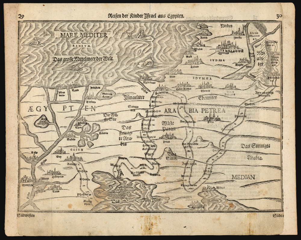
This is a Heinrich Bünting's 1581 map of the Holy Land, depicting the peregrination of the Israelites from Egypt to the Jordan River. The map illustrates the path of the Exodus, numbering the various stops. Biblical scenes are depicted in vignettes: Moses, having crossed the Red Sea, looks back at Egyptians drowning with their chariots; and the army of the Moabites can be seen fleeing their kingdom from the onslaught of the Israelites. The Mediterranean is decorated with a merman (although Laor maintained that this was a depiction of Jonah riding astride, rather than inside, the whale). There are also two giant fish, and a duck.
Publication History and Census
This woodcut appeared first in the 1581 Helmstadt edition of Heinrich Bünting's Itinerarium Sacrae Scripturae, the first book dedicated to describing the journeys taken by figures in the Bible. Its popularity kept it in print into the 18th century. The formschneider is unknown. This example conforms typographically to the 1597 edition of the work. In its various editions, Bünting's book is well represented in institutional collections. Nine examples of the separate map are cataloged in OCLC, but it appears on the market from time to time.
Cartographer
Heinrich Bünting (1545 – 1606) was a Protestant pastor and theologian. He was born in Hanover, and studied theologian Witemberg. He is best known for his book of woodcut maps titled Itinerarium Sacrae Scripturae (Travel book through Holy Scripture) first published in 1581. It was the first complete summary of biblical geography available. More by this mapmaker...
Source
Bünting, Heinrich, Itinerarium Sacrae Scripturae, (Magdeburg) 1597.
Good. Marginal mends; cropped to left and right with some loss to borders. margins reinstated.
OCLC 163817121. Laor, E. Mapping of the Holy Land 142.