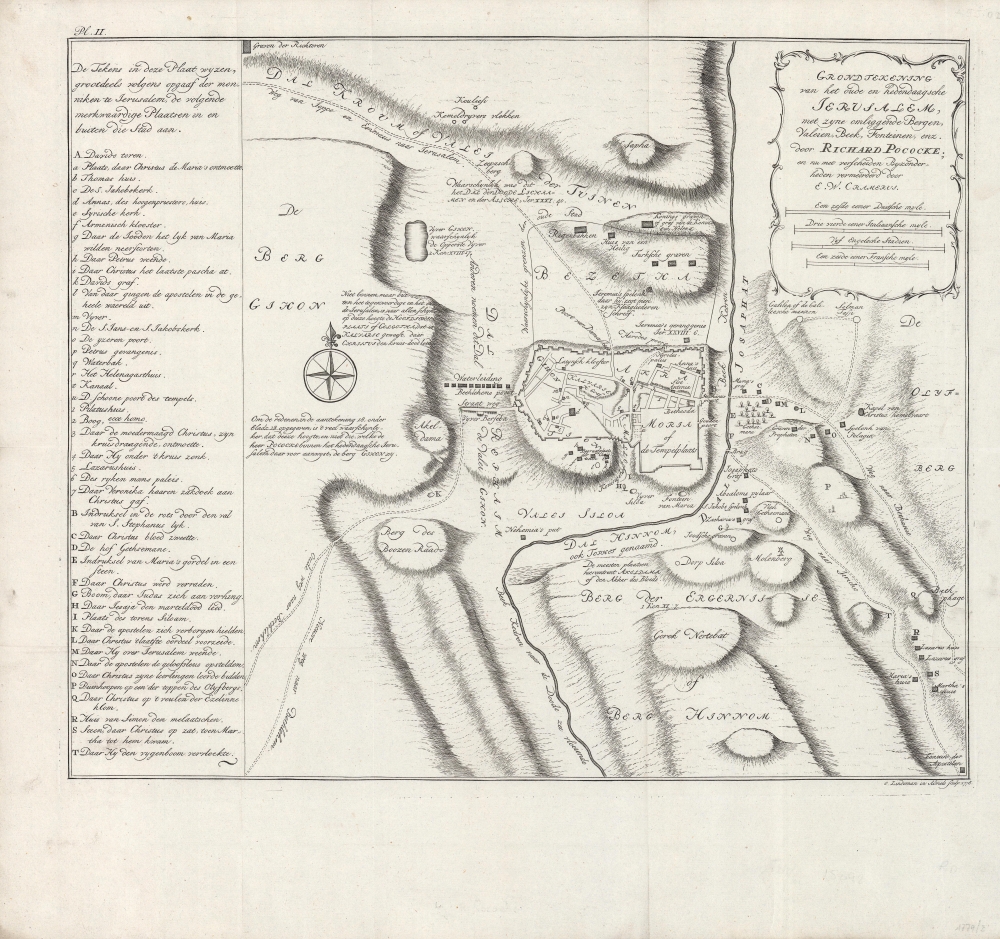
An absorbing 1778 Dutch-language map of Jerusalem, based on Richard Pococke paradigmatic map of the holy city, published in his A Description of the East and Some other Countries. Expanding on Pococke's original considerably, it provides detailed information on important religious sites in and around Jerusalem's Old City.
A Closer Look
Jerusalem's Old City, including the Temple Mount and other religious sites of the highest importance, is readily apparent at center. City gates, water sources, and important historical and religious sites are indicated. Valleys and hills surrounding the Old City are masterfully engraved. The 'modern' city to the north, such as it was at the time, is marked out as 'occupied.' Compared to Pococke's original, this edition focuses more on the city's surroundings and adds extensive explanatory notes, as well as the legend at left.Publication History and Census
This map accompanied a Dutch translation of Pococke's work, A Description of the East and Some other Countries, which was published between 1743 and 1745, then translated into Dutch and published by Johannes Wessing c. 1750 as Beschryving Van Het Oosten, En Van Eenige Andere Landen. The map in Wessing's translation was modified from Pococke's original by R. Schutte, but as indicated in the title here, further additions were made by E. W. Cramerus, with engraving by Otto Lindeman, for this later (c. 1778) printing. This edition of the map is not known to be independently cataloged in any institutional collections and is scarce to the market.
Cartographer
Richard Pococke (November 19, 1704 - September 25, 1765) was an English vicar, traveler, and scholar. He is best known for his works, which combined travelogue and ethnography. Though he travelled throughout the British Isles and Europe, he is best known for his four-year foray into the Muslim world, which was recounted in A Description of the East and Some other Countries, published between 1743 and 1745. More by this mapmaker...
Very good. Light creasing along fold lines. Some faint handwriting in margins.