This copy is copyright protected.
Copyright © 2024 Geographicus Rare Antique Maps
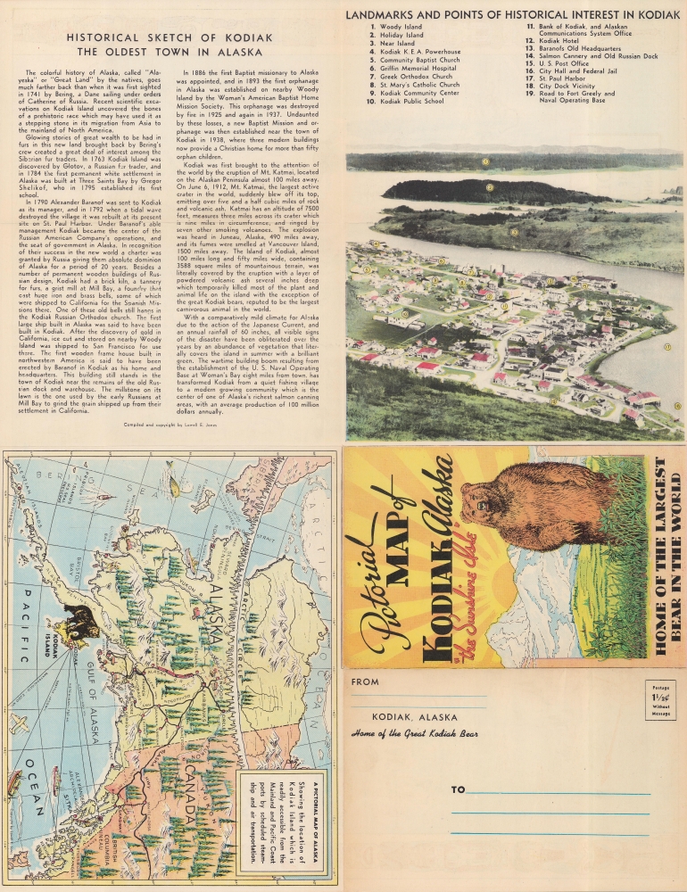
1948 Jones Pictorial Map of Kodiak Island, Alaska
Kodiak-jones-1948-2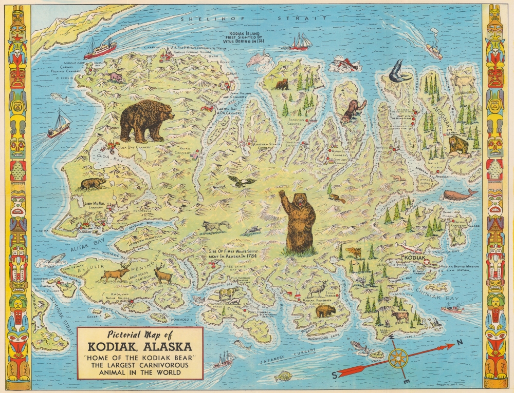

Lowell E. Jones (fl. c. 1935 - 1957) was a Los Angeles graphic artist. He drew pictorial maps and sold them at tourist locations around Los Angeles for twenty-five cents each. More by this mapmaker...
Copyright © 2024 Geographicus Rare Antique Maps | Geographicus Rare Antique Maps
This copy is copyright protected.
Copyright © 2024 Geographicus Rare Antique Maps