This copy is copyright protected.
Copyright © 2024 Geographicus Rare Antique Maps
1832 Brugner City Plan or Map of Lisbon, Portugal
Lissabon-brugner-1832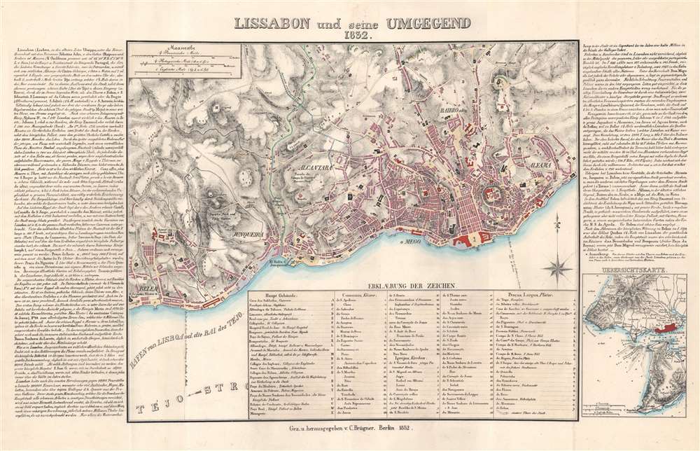

Copyright © 2024 Geographicus Rare Antique Maps | Geographicus Rare Antique Maps
This copy is copyright protected.
Copyright © 2024 Geographicus Rare Antique Maps