This copy is copyright protected.
Copyright © 2024 Geographicus Rare Antique Maps
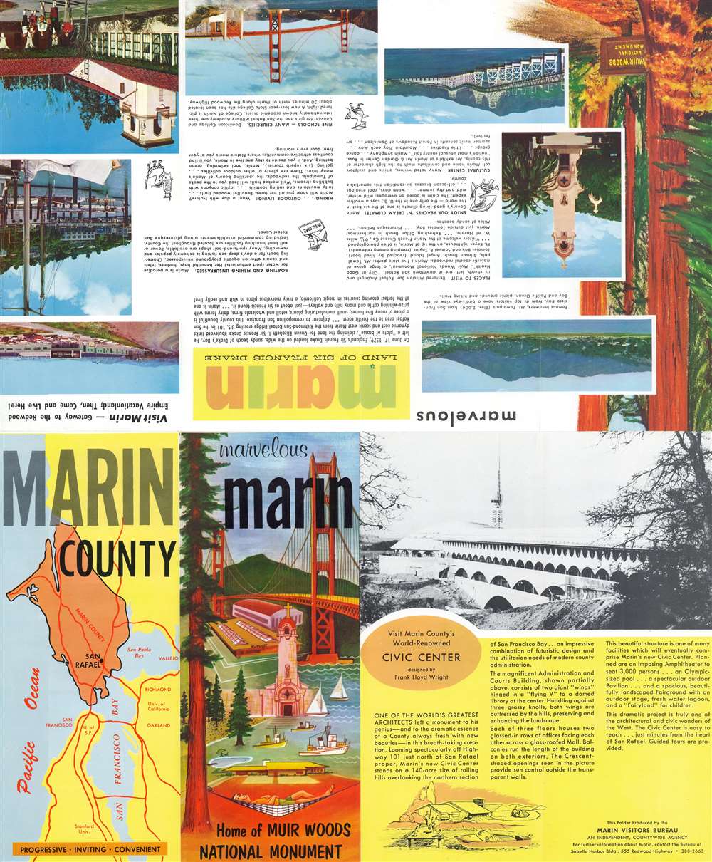
1962 Marin Visitors Bureau Pictorial Tourist Map of Marin County, California
MarvelousMarin-visitorsbureau-1962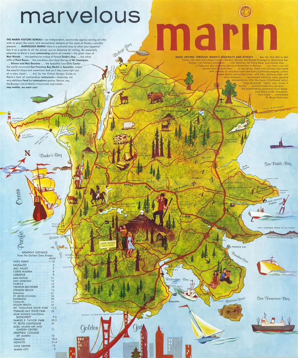

Copyright © 2024 Geographicus Rare Antique Maps | Geographicus Rare Antique Maps
This copy is copyright protected.
Copyright © 2024 Geographicus Rare Antique Maps