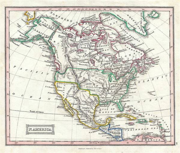
This is a beautiful 1845 map of North America by Thomas Ewing. The map covers the continent from the North Georgian Islands in the Arctic Ocean to South America. Also includes Greenland and Iceland. Includes the Russian and British territories in America, Canada, the United States, Mexico, Central America and the West Indies.
At the time this map was drawn, Canada witnessed the rebellions of 1837 and 1838. In Mexico the rebellion of the English speaking region of Texas caused tension between the liberals and the conservatives within Mexico, as well as between Mexico and the United States. The United States, meanwhile, was rapidly expanding westward. This being a British map, the Crown's claims all lands north of the Columbia River (modern day Washington) are noted.
This map was published in 1845 by Oliver and Boyd as part of Ewing's New General Atlas.
Source
Oliver and Boyd, Ewing's New General Atlas: containing Distinct Maps of all the Principal States and Kingdoms throughout the World, (Edinburgh) 1845.
Very good. Minor foxing at places. Blank on verso.