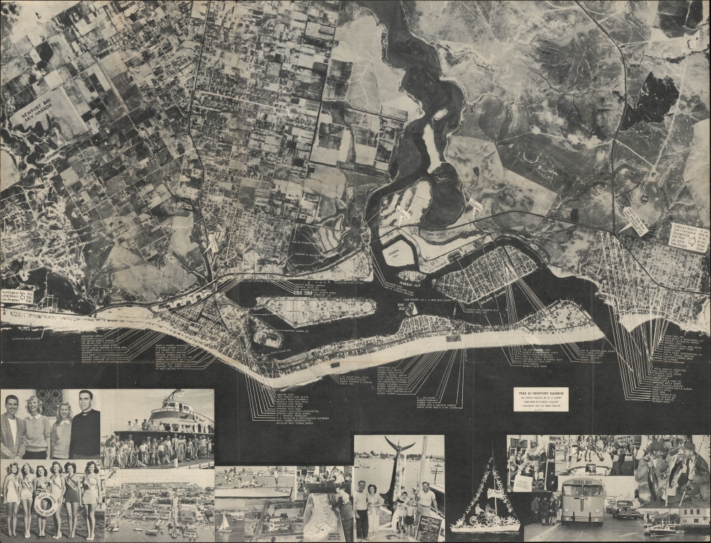
An unrecorded 1948 photographic aerial view of Newport Beach, California, produced by W. S. Hardy and the Santa Ana Printing Co. It presents Newport in the early phase of a long period of tremendous growth that was marked, among other things, by a transition away from the fishing industry.
A Closer Look
Oriented towards the northeast so that the Balboa Peninsula sits nearly horizontal at the bottom, this aerial view covers Newport Beach and much of the adjoining community of Costa Mesa. Some areas on this map were, at the time, unincorporated communities but have since been annexed by Newport Beach. Roads, rail lines, city blocks, and farms are evident throughout. Signs resemble road signs, pointing out the direction and distance of neighboring towns and cities and the Orange County Airport (now known as John Wayne Airport). Throughout are labels pointing to businesses that sponsored the map, which are also advertised on the verso. Below the map are photographs of local festivities, boating, and fishing, which, though formerly the mainstay of the town's economy, were becoming leisure activities.
Construction sites, among them a new city hall and large hotel complex (a photograph of a model of the hotel is included along the bottom), give a sense of the rapid changes taking place in the growing city. (Newport Beach's population nearly tripled between 1940 and 1950 and more than doubled again by 1960.) Peripheral areas were developed to meet the demand for suburban-style housing. The combination of suburban neighborhoods surrounding established, compact commercial districts and proximity to the beach, marinas, and golf courses made Newport Beach a desirable destination and, eventually, one of the wealthiest communities in the country.What's in a Name?
During the 1940s, some community members suggested that changing the city's name would help distinguish it from other Newports in the United States. Also, they disliked the second word in Newport Beach. The local Chamber of Commerce unsuccessfully advocated for changing the city's name to Newport Harbor, which likely explains the use of that phrase here and the complete lack of Newport Beach.Newport's Forgotten 'Sky Harbor'
The Newport Bay Sky Harbor at left grew from an airfield, Orange County's first, established by local aviation pioneer Eddie Martin and others in 1923. Going by several names (including Eddie Martin Field), it developed into a functioning airport with both commercial and recreational flights. The field was closed during World War II (1939 - 1945) due to the development of the nearby Santa Ana Army Airbase (much of which was later sold off to build houses). The 'Sky Harbor' seen here resumed operations after World War II and became known as Costa Mesa Airport. Costa Mesa Airport was demolished in 1953 to make way for a large housing development, opening the way for Orange County Airport to become the primary commercial airport in the region.Pacific Electric's Balboa Line
The black line running from near the top-left and across the Balboa Peninsula is the Balboa Line of the Pacific Electric Railway. It was the southernmost of the Pacific Electric Lines, connecting with Downtown Los Angeles, beginning service in 1904. However, by 1940, the increasing use of automobiles had caused Pacific Electric to drastically reduce service along the Balboa Line, then periodically halt it, with the last passenger train running in 1950 (much of the line continued to be used for freight for several years).Publication History and Census
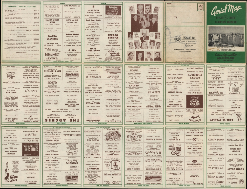
This folding map, designed as a mailer, was produced by W. S. Hardy of the firm Hardy and Elliott (about whom little information is available) and printed by the Santa Ana Printing Co. Although not specified, likely, the '112 local merchants' who cooperated in the map's production were members of the Newport Harbor Chamber of Commerce. This map is not recorded in the OCLC and has no known institutional holdings or history on the market.
Cartographer
Santa Ana Printing Company (c. 1922 - 1981) was a lithographic printer based in Santa Ana, in Orange County, California. Little is known about the firm, but a business directory from 1923 notes it as having been established the previous year by C. E. Stewart and E. J. Horsley. Their output of published works (mostly relating to local government or goings-on) appears to have tapered off in the 1950s, but a business directory from 1981 lists the company as active. More by this mapmaker...
Very good. Light wear and toning along original folds.