1946 Title Insurance Map of Historical Ranchos of Orange County, California

OrangeCountyRanchos-titleinsurancetrust-1946
$200.00
The Old Spanish and Mexican Ranchos of Orange County. - Main View
Processing...

1946 Title Insurance Map of Historical Ranchos of Orange County, California

OrangeCountyRanchos-titleinsurancetrust-1946

When California Had More Cows than People.
$200.00

Title


The Old Spanish and Mexican Ranchos of Orange County.
  1946 (dated)     20.5 x 21 in (52.07 x 53.34 cm)     1 : 130000

Description


A curious c. 1946 map of Orange County, with the area's historic ranchos superimposed on a contemporary map. It was published by the Title Insurance and Trust Company, which had a penchant for producing similar maps related to Southern California's history and culture.
A Closer Look
Orange County, California is displayed with land plots as of 1946 traced. Though the area was still largely agricultural (Irvine barely registers as a crossroads here), several sizable cities (Anaheim, Orange, Santa Ana), along with coastal towns such as Huntington Beach and Newport Beach, can readily be recognized. Waterways, mountains, military bases, mines, roads, rail lines, and other features are also noted.

Color shading denotes 18 historic ranchos and potreros in part or whole. The large Rancho Santiago de Santa Ana, including the eponymous city, shaded red at center towards top-left, was one of the largest ranchos in Southern California. A note at the bottom points to where 'the first white men entered Orange County' in 1769.
The Ranchos of Orange County
Ranchos were awarded in Alta California by the Spanish, and later, on a much larger scale, by independent Mexico as land grants to soldiers and others to encourage settlement in the far-flung territory, where the European presence was mostly limited to Catholic missions. Typically, the large parcels of land were dedicated to grazing cattle or sheep. Although this system was unquestionably detrimental to the indigenous population, who either fled inland or were virtually enslaved in the ranchos and missions, it did provide opportunities for mestizos and others of mixed ancestry, most famously Pio Pico, who was one of the wealthiest men in Alta California and its last governor under Mexican rule. However, the Mexican-American War, along with the sudden transition to U.S. statehood and the California Gold Rush, led to many rancheros being dispossessed of their lands through violent or unscrupulous means. An exception to this trend was Don Bernardo Yorba, owner of the Rancho Santiago de Santa Ana and Rancho Cañón de Santa Ana, and the namesake of Yorba Linda, who retained his land and wealth even after California joined the United States.
Publication History and Census
This map is based on a 1946 official map of Orange County and was published by the Title Insurance and Trust Company soon afterward as part of a booklet by W.W. Robinson titled The Old Spanish and Mexican Ranchos of Orange County. This booklet was published in multiple editions from the early 1950s into the 1960s, with the earlier editions being undated. The present map is less common than a somewhat later map of the same title also published by the Title Insurance and Trust Company that was drawn by Lowell Butler (Rumsey 9626.000).

Cartographer


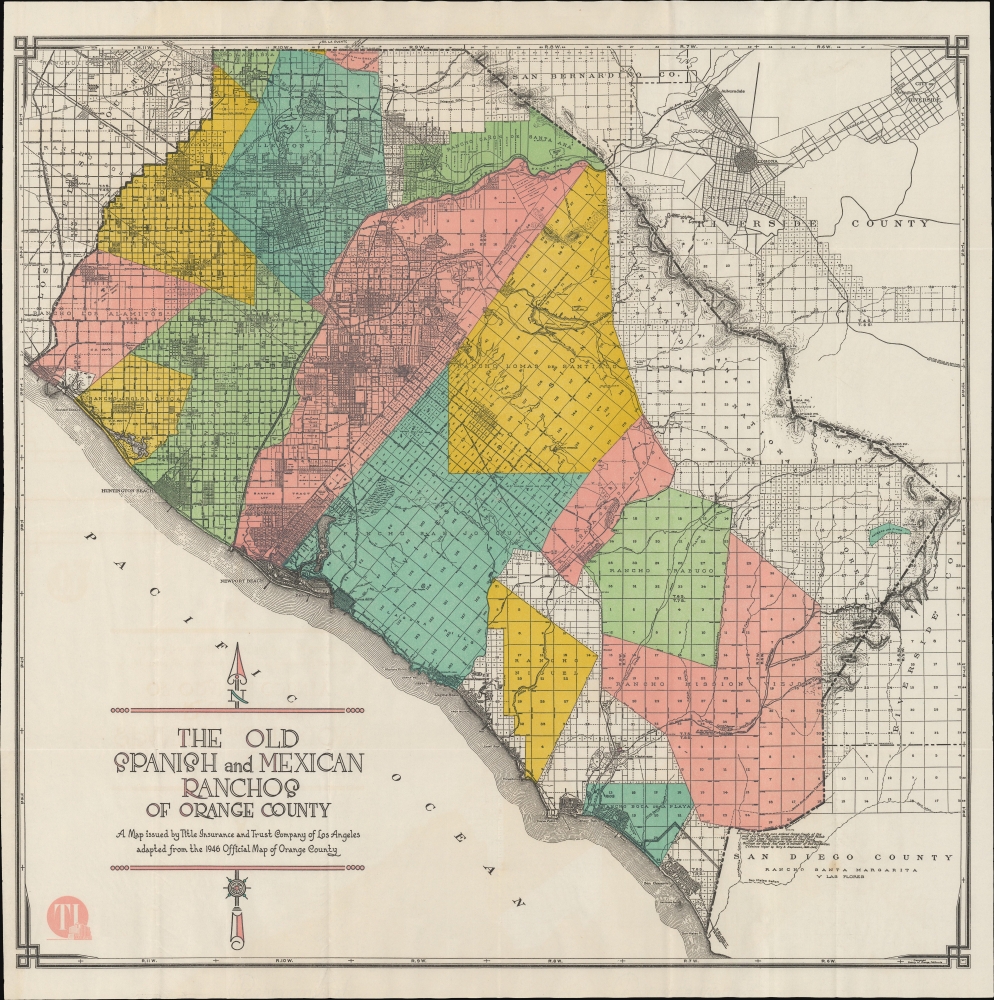
Title Insurance and Trust Company (c. 1886 - 1981) was a title insurance company based in Los Angeles. Among map collectors, it is known for commissioning colorful and visually impressive maps of California cities and counties, including ones related to local history. Perhaps most memorably, they produced a series of maps tracing the ranchos of the Spanish and Mexican eras of Alta California in different modern-day counties. More by this mapmaker...

Condition


Very good.

References


OCLC 25126939, 191108815, 61288462.