1948 Redwood City Tribune Map of Redwood City and its Vicinity

RedwoodCity-granucci-1948
$450.00
Map of Redwood City and Vicinity San Mateo County, California Revised and Issued By The Redwood City Chamber of Commerce. Revised December 1st., 1948. - Main View
Processing...

1948 Redwood City Tribune Map of Redwood City and its Vicinity

RedwoodCity-granucci-1948

Rare, Detailed Plan of Redwood City Promoting the City and its Erstwhile Paper of Record
$450.00

Title


Map of Redwood City and Vicinity San Mateo County, California Revised and Issued By The Redwood City Chamber of Commerce. Revised December 1st., 1948.
  1948 (dated)     20.75 x 31.75 in (52.705 x 80.645 cm)     1 : 14000

Description


A rare 1948 map of Redwood City, drafted by Arthur F. Granucci for the Redwood City Chamber of Commerce and the Redwood City Tribune. Areas falling within the actual Redwood City limits are colored gold, but the map shows the neighboring areas as well.  It encompasses the area from Brittan Avenue to Marsh Road, and from Bayshore Road to Cañada Road.  Emerald Hills is particularly well detailed:  Emerald Lake and Upper Emerald Lake both appear amongst the winding streets of the hilly neighborhood.  An inset map shows the Port of Redwood City and its wharves.
Publication History and Census
This city plan is rare. It does not appear in auction records or dealer catalogues. One example of this 1948 edition is held by the University of Wisconsin in Milwaukee; a further 1946 issue appears to exist in the Stanford University Library collection.

Cartographer


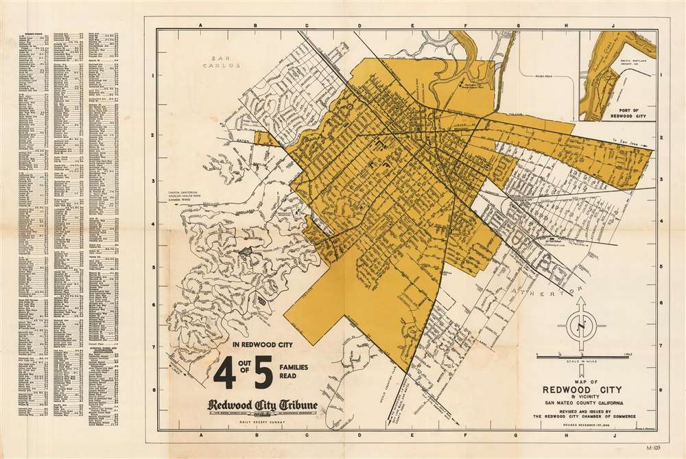
Arthur F. Granucci (1901-1978) was an American draftsman living in San Mateo county, California. He appears to be credited in the production of one map, the ‘Map of Redwood City & vicinity’ produced in 1948 by the Redwood City Chamber of Commerce. It is likely that an earlier 1946 edition of this map is also his work. More by this mapmaker...

Condition


Very good condition. Marginal mend at one fold away from printed image.

References


OCLC 63197984.