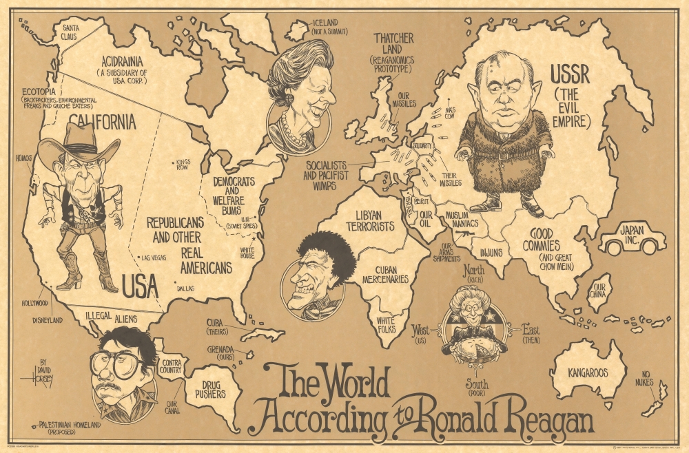
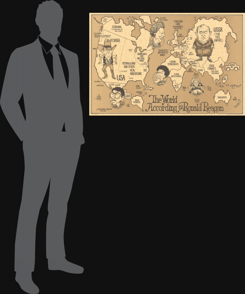
An entertaining David Horsey 1987 satirical map of the world framing the Cold War as an old-west style gunfight between American President Ronald Reagan (1911 - 2004) and Soviet President Mikhail Gorbachev (1931 - 2022).
A Closer Look
Here Horsey pokes fun at the dualistic view of world politics embraced by Reagan during the Cold War. The United States and Russia are grossly inflated in proportion to the rest of the world - reflecting their significance. In the United States, President Ronald Reagan stands in full western regalia, opposing Mikhail Gorbachev, dressed in a fur coat and standing over the USSR. They stare one another down, each ready to pull their weapons. Additional figures include Margaret Thatcher (England), Muammar Gaddafi (Libya), José Daniel Ortega Saavedra (Nicaragua), and Nancy Reagan holding out her famous pumpkin pie.
Text throughout describes the world as Horsey jokingly suggests Ronald Reagan might see it. The United States is domineeringly huge, and within it, California is oversized. New England is relegated to 'Democrats and Welfare bums'. South America is presented as the home of 'Drug Pushers' and Iran is full of 'Muslim Maniacs' despite receiving 'our arms shipments'. Europe is full of 'socialists and pacifists wimps'. England, 'Thatcher Land' is proposed as a prototype for Reagan's 'trickledown' economic theories. Canada (Acidrainia), Saudi Arabia, and Japan are described as fiscal subsidiaries of the United States.The Cold War
The Cold War (1947 - 1991) was a geopolitical conflict between the United States and the Soviet Union and their respective allies, the Western Bloc and the Eastern Bloc, which began following World War II (1939 - 1945). The Cold War is generally considered to have begun with the 1947 Truman Doctrine and ended with the 1991 dissolution of the Soviet Union. During the conflict, both the United States and the Soviet Union developed powerful nuclear arsenals. While there was always a threat of nuclear war, the apocalyptic cost of such an exchange kept both sides from engaging in direct warfare. Instead, with no large-scale engagement, the Cold War was fought through various proxy wars, espionage, propaganda campaigns, embargos, and psychological warfare. Each superpower supported major regional conflicts centered around an ideological and geopolitical struggle for global influence.Publication History and Census
This map was drawn by David Horsey and published in 1987 by AA Graphics of Seattle. Its official name is 'PC0288 Reagan's World II', marking this as the 2nd edition. The first edition, titled 'P 237 The World According to Reagan', was issued by the Seattle Post Intelligencer in 1982. We located this map in perhaps thirteen institutional collections. It is scarce on the market.
Cartographer
David Horsey (1951 - Present) is an American editorial cartoonist and commentator. He was born in Evansville, Indiana, but relocated to Seattle, Washington by age 3. He studied at the University of Washington before taking work as a political reporter at the Daily Journal-American, Bellevue, Washington. He twice won the Pulitzer Prize (1999, 2003) for political cartooning. His work has since appeared in hundreds of media outlets, among them the New York Times, Washington Post, USA Today, Politico, MSCNBC, the Seattle Post-Intelligencer, the Los Angeles Times, and the Seattle Times. He remains active with the Seattle Times. More by this mapmaker...
Very good.
Rumsey 11493.000. OCLC 30812627.