A separately-issued 1906 folding map of Salem, Massachusetts published by George H. Walker and Co. in Boston. It depicts the entirety of the city in considerable detail, from its rural southern portion through its historic center in the north.
A Closer Look
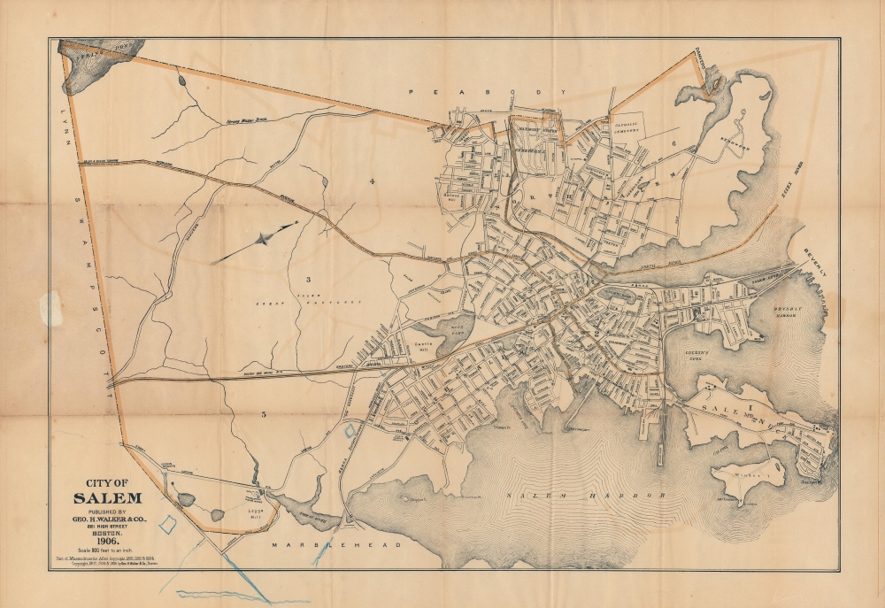
This map is oriented towards the west-northwest, with north at right. Numbers indicate city wards, which are outlined in yellow. Roads, rivers, railways, important buildings, and other features are indicated. Blue pencil annotations at bottom likely indicate subsequent developments after the map's publication.
The bridge at right over 'Salem Cove' is the steel truss bridge the predecessor to today's Veterans Memorial Bridge (Beverly-Salem Bridge), which opened in 1997. As suggested here, the steel bridge (opened in 1896) initially included streetcar tracks of the Bay State Street Railway. The year after this map was published, a second bridge connecting Beverly and Salem opened in the Kernwood neighborhood, at top-right here.
To the annoyance of at least some locals, Salem is best known for the infamous witch trials that occurred there in the late 17th century. Its later history was largely defined by the fishing industry and maritime trade, with destinations as far away as China and the Spice Islands of Southeast Asia. By the time this map was made, however, these maritime industries had faded and the city transitioned to various manufacturing industries, aided by the (Massachusetts and) Lawrence Railroad and Boston and Maine Railroad, prominent here. The Boston and Maine tracks are today utilized by the Massachusetts Bay Transportation Authority Commuter Rail service on the Newburyport/Rockport Line.
Although Salem suffered a terrible fire in 1914, much of the historic center of the city was not damaged. Today, aside from the crush of tourists each October drawn by witch-themed Halloween festivities, the city's economy is largely sustained by museums, restaurants, and shops housed in these historic buildings, including the Peabody-Essex Museum (here as 'Peabody Academy' near the intersection of Essex and Liberty Streets) and 'The House of the Seven Gables,' inspiration for Nathaniel Hawthorne's eponymous 1851 novel (located at the end of Turner Street on the city's historic waterfront).Publication History and Census
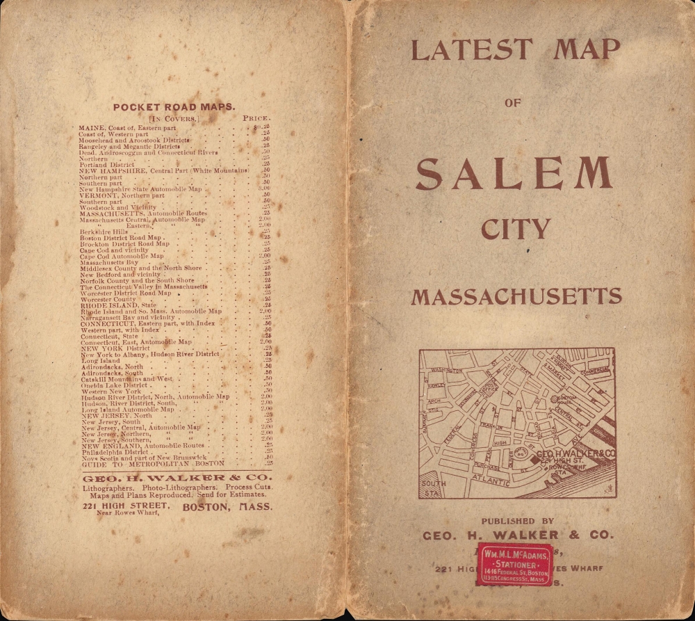
As indicated in the information below the title, the first edition of this map dates to 1891 and originally appeared in O.W. Walker's Atlas of Massachusetts. It was subsequently printed by George H. Walker and Co. (no known relation) as a separate issue folding map, as here. It continued to be printed afterwards until at least 1916. As one of the most prolific map publishers in New England at the time, George Walker was well-acquainted with Salem, even publishing a dedicated atlas of the city in 1911.
The 1906 edition of the map has an OCLC identifier but is not noted among the holdings of any institution, and in any event is logged as being part of that year's edition of the Massachusetts Atlas rather than a separate issue. We are not aware of any other examples of separate issue printings of this map, regardless of the year.
Cartographer
George Hiram Walker (January 4, 1852 - November 14, 1927) was a Boston based publisher of books, views, and maps active in the late 19th and early 20th centuries. Born in Springfield, Vermont, Walker started his life as a dry goods merchant but developed an active interest in publishing during the early 1870s. Walker began publishing in 1878 when he partnered with an unknown New York Firm. Two years later, Walker brought the operation in house by partnering with his brother, Oscar W. Walker, in the opening of a lithography studio at 81 Milk Street, Boston. Shortly thereafter the firm expanded to new offices at 160 Tremont Street, Boston. The Walker brothers produced a large corpus of works, most of which focused on travel and tourism in New England. Walker also established the Walker-Gordon Milk Laboratory with Dr. Thomas Morgan Rotch and Gustave Gordon. This interesting investment was based on the premise that infant deaths could be avoided by providing higher quality milk. The company eventually became a great success, producing a high-quality cow milk that closely resembled human breast milk. In the process the Walker-Gordon laboratory developed many of the dairy health standards that are still with us today. Walker married Irene L. Loud on March 25, 1885. More by this mapmaker...
Very good. Light wear along original fold lines. Light toning. Verso repairs to fold separations. Old tape repairs on verso. Accompanied by original binder.
OCLC 47910881.