Title
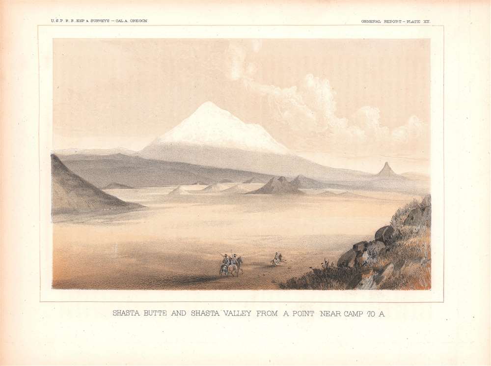
Shasta Butte and Shasta Valley From A Point Near Camp 70 A.
1855 (undated)
6 x 8.75 in (15.24 x 22.225 cm)
Description
This is an 1855 view of Mt. Shasta and the Shasta River Valley in northern California, near the border with Oregon. The view was made by agents of the Pacific Railroad Surveys, an important precursor to the Transcontinental Railroad and also a great storehouse of research material about the environment and peoples of the American West just after these areas were incorporated into or conquered by the United States.
A Closer Look
Mt. Shasta is a large volcano, possibly active, in northern California near the border with Oregon. This view illustrates the mountain and the Shasta Valley, which has been designated a wildlife area since 1991. Much of the area surrounding the mountain is also part of the Shasta-Trinity National Forest, the largest in California. At the time of the Pacific Railroad Surveys, these lands were still almost exclusively inhabited by indigenous peoples. Hudson Bay Company traders sometimes transited the area along the Siskiyou Trail, a historic Native American travel and trade route, as did increasing numbers of Americans in the 1840s, but white settlement only began on a large scale in 1851 with a gold rush at nearby Yreka. The railroads arrived in the following decades, while violence, disease, and displacement significantly reduced the indigenous population.The Shasta River and California's Water Crisis
Through both natural and manmade means, including the Shasta Dam (completed 1945) and the resulting Shasta Lake, runoff from Mt. Shasta and other nearby mountains provides much of the freshwater for areas to the south, especially the Central Valley, an agricultural powerhouse. The dam, still one of the largest in the world, was the crowning achievement of the federal government's Central Valley Project.
As California's sources of freshwater have been increasingly imperiled in recent years by droughts and rising temperatures, proposals have been made to raise the dam to allow for greater storage of the abundant waters running off the mountains along the California-Oregon border, but environmental groups and the indigenous Wintu people, whose lands were almost completely flooded by the original dam project, have opposed these efforts.The Pacific Railroad Surveys
Following the annexation of Texas and Upper California at the end of the Mexican-American War, the United States found itself controlling a coast-to-coast empire. The 1849 California Gold Rush led to rapid westward expansion and a population bubble on the west coast. Connecting California to the Eastern Seaboard with an overland railroad route was essential to the growth and stability of the country.
Hopes for the railroad where high, and Congress authorized a series of preparatory surveys of practical routes, known collectively as the Pacific Railroad Surveys, which were completed between 1853 and 1855. The resulting reports, including maps, plates, charts, and graphs, provided an incredible body of data about the ecology and cultures of the western regions of North America soon after their incorporation into the United States. The present view, along with others accompanying the surveys, highlight the fundamental duality of the West, a harsh and hostile environment that is simultaneously indescribably beautiful.
While all agreed on the importance of a Pacific Railroad, not everyone in power was ready to act. Lobby groups published propaganda to illustrate the benefits of the route, and ultimately, in 1862, Congress passed the Pacific Railway Act, leading to the chartering of the Union Pacific Railroad Company, charged with constructing the route. But by this time the United States was fully embroiled in the American Civil War (1861 - 1865), which further stymied construction. In was not until May 10, 1869, that the robber baron and railroad tycoon Leland Stanford drove the Golden Spike at Promontory Summit, Utah Territory, linking the eastern and western spurs of the Pacific Railroad, creating the first transcontinental railroad.Publication History and Census
This view was included as Plate XII in Volume VI of the Reports of explorations and surveys: to ascertain the most practicable and economical route for a railroad from the Mississippi River to the Pacific Ocean. While the Reports are well represented in the OCLC, this view is not known to be cataloged independently by any institution and is very scarce to the market.
Cartographer
The Pacific Railroad Surveys (1853 - 1855) were established in 1853 with the goal of identifying the best possible routes for a transcontinental railroad from the Mississippi to the Pacific. The need for transcontinental railroad made itself evident shortly after the California Gold rush when the westward expansion was at its heights. The federal government, acting under the Sectary of War, Jefferson Davis (of Civil War fame), initiated a series of expeditions of the western territories. These expeditions included surveyors, cartographers, artists, zoologists, botanists and geographers. The resultant work, a 12 volume compendium entitled Reports of Explorations and Surveys, to ascertain the most practicable and economical route for a railroad from the Mississippi River to the Pacific Ocean eventually led to the constructions of several different transcontinental railroads. More by this mapmaker...
Source
Reports of explorations and surveys to ascertain the most practicable and economical route for a railroad from the Mississippi River to the Pacific Ocean, Volume VI: Routes in Oregon and California.
Condition
Very good. Some toning in the margins.