This copy is copyright protected.
Copyright © 2024 Geographicus Rare Antique Maps
1986 Russell Pictorial Map of Silicon Valley, California
SiliconValley-russell-1986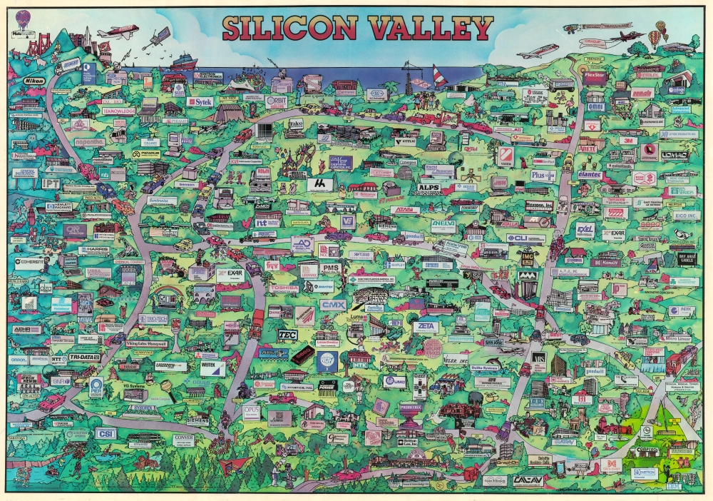


Copyright © 2024 Geographicus Rare Antique Maps | Geographicus Rare Antique Maps
This copy is copyright protected.
Copyright © 2024 Geographicus Rare Antique Maps