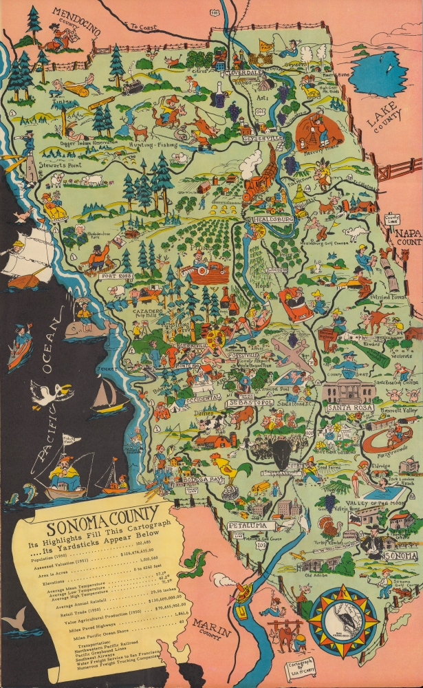
A charming pictorial map of Sonoma County, California, drawn by Lea McCarty around 1951 for the Sonoma County Board of Supervisors and a consortium of local chambers of commerce. It covers multiple episodes from the county's history while discussing its present character and economic potential, especially with regard to agriculture.
A Closer Look
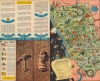
The view offers a slice of California's history and culture, from Native Americans to mid-20th century Americana. A monument in the city of Sonoma marks the site of the Bear Flag Revolt, an 1846 revolt that coincided with the opening phase of the Mexican-American War (1846 - 1848), briefly created an independent republic, cleared the path for California to join the United States of America, and gave California the flag it still uses today. A figure in Russian dress holding a Russian imperial flag marks the site of Fort Ross, a Russian trading post on the California coast. Other figures throughout represent elements of the county's history, culture, and economy, which was mostly agricultural at this time (including viticulture). The county line is traced with a barbed wire fence, reflecting the presumed attitude of Sonomans toward their neighbors. As with most pictorial maps or cartographs of this era, attempts at humor reinforce contemporary racial stereotypes, such as the sleeping Indian at the Digger Reservation.
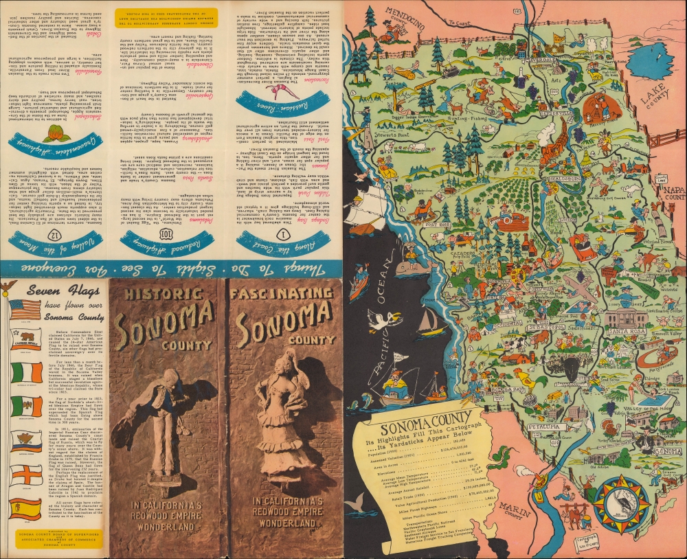
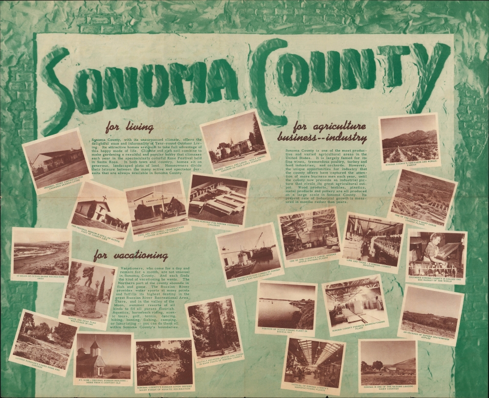
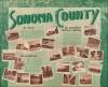
Statistics at bottom-left provide information on the county's population, land area, value of lands, climate, infrastructure, and economy. Additional information on the recto discusses highway transportation to the county, recreational activities, and the seven flags that have flown over the county. The verso includes additional promotional text and imagry, praising the county's suitability for living, recreation, and business.Publication History and Census
This view was drawn by Lea McCarty for the Sonoma County Board of Supervisors and the Associated Chambers of Commerce of Sonoma County. It is undated, but the statistics at the bottom left include land value figures from 1951, suggesting that this was published that year or soon afterward. The only institutional holding we have been able to identify is at the University of California Berkeley.
Cartographer
Lea Franklin McCarty (1905 - 1960) was a painter, illustrator, and sculptor best known for his depictions of the 'Old West,' in particular his life-size portraits of gunslingers, such as Jesse James, Wild Bill Hickok, Wyatt Earp, and Doc Holliday. Born in Los Angeles, McCarty studied at the University of Southern California and the Chouinard Art School. He became fascinated with the Old West and began work on his thoroughly-researched portraits, more than 100 of which he produced by the time of his death. Soon before his death, a book titled Gunfighters of the Old West was published, including reproductions of his portraits and biographical information on some twenty of the most famous gunslingers. More by this mapmaker...
Very good. Some wear along fold lines and edge. When fully unfolded, map measures 11 x 18 in. on a sheet 22 x 18 in.
OCLC 21651305.