1944 Fore Map of the World and the Future of Air Travel

TomorrowsWorld-fore-1944
$225.00
Tomorrow's World: Closer to Home. - Main View
Processing...

1944 Fore Map of the World and the Future of Air Travel

TomorrowsWorld-fore-1944

Dawn of the Air Travel.
$225.00

Title


Tomorrow's World: Closer to Home.
  1944 (undated)     26 x 19.25 in (66.04 x 48.895 cm)

Description


This is a c. 1944 Marc R. Fore and Newsweek map of the world illustrating the global 'shrinking' effect of air travel. Centered on Washington, D.C., the world is presented on an azimuthal equidistant projection, allowing distances to be illustrated by concentric circles superimposed over the map. Each circle marks 2,000 miles and ten hours of flight time, with the largest marking locations 10,000 miles and fifty flight hours away from Washington. Several global air travel hubs are identified, including London, Paris, Berlin, Sydney, Melbourne, Calcutta, and Cape Town. The caption below the map states, 'weeks of travel under adverse conditions will be reduced to a few air-hours of comfortable flight in an air-conditioned stratoliner above the clouds'.
Publication History and Census
This map was created by Marc R. Fore and published by Newsweek c. 1944. We note a single cataloged example, which is part of the collection at the Hoover Institution Library and Archives.

Cartographer


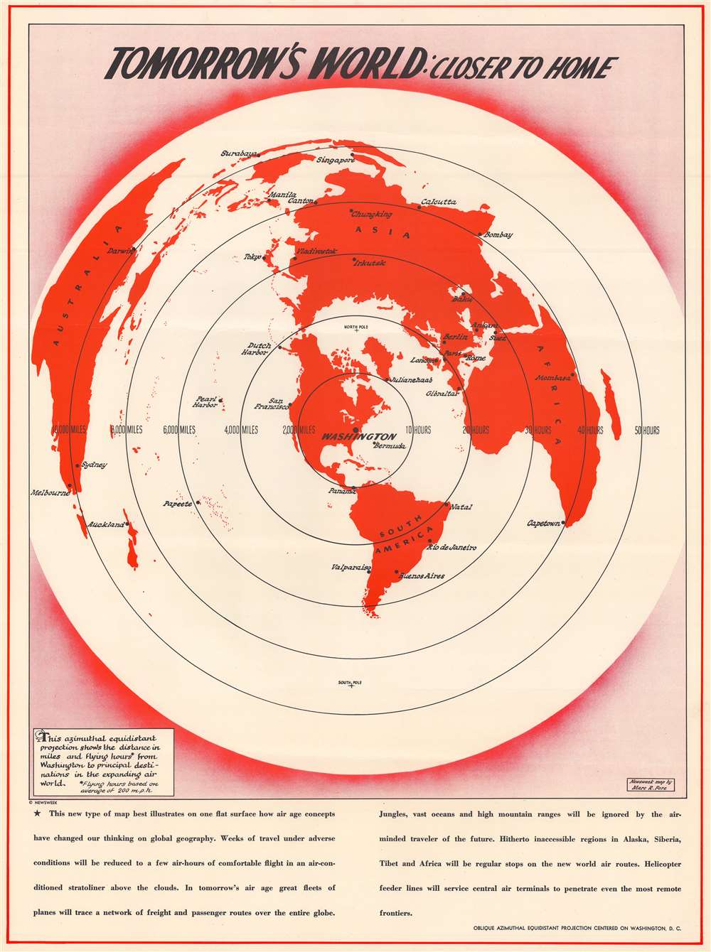
Marc Randall Fore (December 17, 1903 - December 27, 1992) was the chief of the Newsweek Map Department and became an advertising executive. Born in Pittsburg, Fore lived in Long Island, New York, and Washington, D.C., and began his career as a commercial artist and then worked in design, advertising, and promotion for Newsweek, the Washington Times-Herald, U.S. News and World Report, and The Houston Post, among others. He also edited a portrait biography of U.S. World War II leaders entitled The Admirals and the Generals. More by this mapmaker...

Condition


Very good. Some creasing.

References


Hoover Institution ID Poster US 7692.8.