
1907 Walker Pocket Map of New Hampshire, Lakes Region and White Mountains

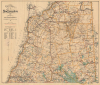
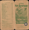
Central New Hampshire / Central New Hampshire including the White Mountain District.
Heart of the White Mountains.
- Digital Map Information
- Suitable for large format printing
- Full resolution TIFF file
- ICC color profile embedded
- Delivered instantly via download link
Heart of the White Mountains.
This is a rare c. 1907 George Walker pocket map of central New Hampshire, covering the heart of the White Mountains, including the Presidential Range, and the northern part of New Hampshire's Lakes Region. It was published at the height of the turn-of-the-century White Mountains tourism boom.A Closer Look
The map covers from Lancaster and Berlin at top to Lake Winnipesaukee (here spelled as Winnipiseogee) at bottom, taking in the White Mountains and much of the Lakes Region, including Squam (Asquam) Lake and Ossipee Lake. Township borders are traced throughout, along with railroads, roads ('automobile and bicycle routes' traced in red), post offices, waterways, and mountains with elevations noted. Hachure lines mark out elevation, while tables at left record the elevation of major lakes, towns, and hotels. Among the railways depicted is the Maine Central Railroad, which ran through Crawford Notch, providing excellent views of the Presidential Range (a portion still operates as the Conway Scenic Railroad), and the Mt. Washington Cog Railway, the steepest portion of which, dubbed 'Jacob's Ladder,' appears on the map's cover.Summiting Mt. Washington, the Easy Way
Hiking up Mt. Washington is no easy feat, and can be downright dangerous for those unprepared, especially given the equipment and dress prevailing at the time of this map's publication. Therefore, from the early days of the White Mountains' history as a vacation destination, various methods were devised to enable people to more easily access the summit. The path leading up the mountain's east side, starting near the Glen House, is a carriage road that eventually became the Mount Washington Auto Road (the first ascent by an automobile was completed in 1899 by Freelan O. Stanley in one of his own steam-powered automobiles). Meanwhile, the railroad departing from near Fabyan House to the west of the mountain is the famous cog railway, in operation since 1868, the first mountain-climbing cog railway in the world. Considered a mad scheme when proposed by Sylvester Marsh, it remains in operation and is still the second-steepest rack railway in the world.America's Favorite Mountain Retreat
At the time of this view's publication, the White Mountains were the preferred rustic retreat of urbanites from Boston, New York City, and other coastal cities, especially in the summer, when the heat and smells of the city became oppressive. With railways providing ready access, an entire economy grew to cater to this elite clientele, including luxury hotels, which were directly accessed by the railways. Aside from passenger railroads, logging railroads also began to crisscross the region in the decades after the U.S. Civil War (some lines, including the Maine Central, carried both passengers and freight), allowing for a rapid expansion of the logging industry. Forests were clear-cut throughout this region around the turn of the 20th century, but almost as quickly began to regrow; the establishment of the White Mountain National Forest in 1918, along with a decline of logging in northern New England, laid the groundwork for the magnificent forests seen today.Publication History and Census
This map was prepared by George Walker and Co. around the turn of the 20th century. It is undated, and from the features present, it was issued sometime between 1893 and 1908 (for comparison, see our WhiteMountainsNewHampshire-walker-1893), probably closer to 1908. The mention of automobiles on the map itself and automobile maps on the cover, as well as the address given for the company (400 Newbury St., its home from 1907 if not earlier, as opposed to the earlier 60 Tremont St.) would suggest a date closer to 1908.Due to uncertainty over the publication date, the co-mingling of physical and digital examples in catalog listings, and the map's being variously cataloged by the title on the map itself versus the cover title, the cataloging of this map is not entirely consistent. A 1905 dated edition of the map is listed among the holdings of six institutions in the OCLC, while the 1908 edition is held by four institutions.
Cartographer
George Hiram Walker (January 4, 1852 - November 14, 1927) was a Boston based publisher of books, views, and maps active in the late 19th and early 20th centuries. Born in Springfield, Vermont, Walker started his life as a dry goods merchant but developed an active interest in publishing during the early 1870s. Walker began publishing in 1878 when he partnered with an unknown New York Firm. Two years later, Walker brought the operation in house by partnering with his brother, Oscar W. Walker, in the opening of a lithography studio at 81 Milk Street, Boston. Shortly thereafter the firm expanded to new offices at 160 Tremont Street, Boston. The Walker brothers produced a large corpus of works, most of which focused on travel and tourism in New England. Walker also established the Walker-Gordon Milk Laboratory with Dr. Thomas Morgan Rotch and Gustave Gordon. This interesting investment was based on the premise that infant deaths could be avoided by providing higher quality milk. The company eventually became a great success, producing a high-quality cow milk that closely resembled human breast milk. In the process the Walker-Gordon laboratory developed many of the dairy health standards that are still with us today. Walker married Irene L. Loud on March 25, 1885. Further Details...
Condition
Very good. Verso repairs along closed tears, some fold lines.
References
OCLC 43060478 (1905 ed.), 999502675 (1908 ed.).