
1961 Jacobs Map of Central Park, New York City


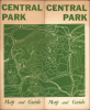
Central Park. / Central Park Map and Guide.
Accomplished Self-Published Map, called 'the most detailed and accurate map of the area ever printed.'
Accomplished Self-Published Map, called 'the most detailed and accurate map of the area ever printed.'
This remarkable 1961 map of Central Park in New York City was independently surveyed, drawn, and self-published by artist and park enthusiast Laura Jacobs. Frustrated by the inadequacy of existing maps, including those issued by the New York City Parks Department, Jacobs set out to map the park herself, documenting its labyrinth of walking paths, bridle trails, playgrounds, statues, ponds, historic sites, and hidden corners. The result was an extraordinarily detailed portrait of Central Park, hailed upon publication as 'the most detailed and accurate map of the area ever printed.'A Closer Look
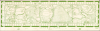
The map is oriented with west at the top, as is common with maps of Central Park, to allow for a horizontal depiction of the park. Nearby streets and avenues are labeled, and a grid surrounds the map for orientation. Landmarks around the park's edge, such as Columbus Circle, the Frick Collection, and the American Museum of Natural History, are illustrated. Within the park, the map notes key features such as the Great Lawn and the Receiving Reservoir (now the Jacqueline Kennedy Onassis Reservoir). But what makes this map unusual is its incredible attention to detail: it traces bicycle, bridle, and footpaths; names playgrounds and larger statues; and even records the sites of historical structures like Fort Clinton and Fort Fish.The information on the verso is equally remarkable, given that it came from a single person's efforts, and it provides practical details such as entry times, fees, and restrictions. For instance, 'From April to November, anyone under the age of 17 can fish at the Lake (C2) without a license. Adults, however, must have a New York State Fresh Water Fishing License' and 'Rowboats may be rented at the Loeb Memorial Boathouse (D4) for use on the Lake and at the 110th Street Boathouse (K4) for use on the Harlem Meer. The rental fee at both boathouses is 45 cents per hour for one person plus 15 cents for each additional person. A $2 deposit is required. Children must be accompanied by someone at least 16 years old.'
The Map's Production
The story of this map's production was so unusual that it was written up in both the Daily News and the The New York Times upon its publication. Jacobs, who had a lifelong love of Central Park and lived nearby, worked as a layout artist for the Association for the Aid of Crippled Children. While enjoying the park immensely, she found publicly available maps, namely those produced by the Parks Department (now the Department of Parks and Recreation), lacking. Drawing on her artistic skills and familiarity with the park, Jacobs set about making her own map detailing the park's many nooks and crannies and self-published it in 1961. The map was hailed at the time of its publication as 'the most detailed and accurate map of the area ever printed' (Daily News, Sunday, July 09, 1961, p. 6).Publication History and Census
This map was prepared and published by Laura Jacobs in 1961. Since its print run was small, it is scarce today, with examples held by the University of Michigan, the New York State Library, and the Bibliothèque nationale de France.Cartographer
Laura Jacobs (fl. c. 1960 - 1962) was an artist and amateur cartographer active in New York City. The details of her life are sparse and difficult to trace due to the commonness of her name and the possibility that she married and changed her last name. Jacobs, born c. 1929, grew up in a tenement on the Lower East Side of Manhattan. Perhaps due to the drabness of her surroundings, she became enamored with Central Park and as an adult moved to W. 57th St. to be adjacent to it. While working as a layout artist for the Association for the Aid of Crippled Children and enjoying the park in her free time, Ms. Jacobs found existing maps produced by the City's Parks Department to be completely inadequate, providing only a sparse outline of the park's many features and very little practical information on attractions such as opening hours and price of admission. She then spent several months compiling her own map, surveying the park on foot and consulting records from the New York Historical Society, among other sources. Spending a hefty sum for the time ($700), Jacobs self-published her map and then arranged for them to be sold at the New York Historical Society and American Museum of Natural History. Her map was very comprehensive, carefully mapping all the park's bridle paths, for example, and was especially useful for including information on opening times and fees (if any) for various attractions and facilities in the park. Further Details...
Condition
Good. Marginal mend, reinforced scuff, else very good.
References
OCLC 50680912. Devlin, J., 'Friend of Central Park Draws Map to Share Her Knowledge; Woman Artist Spent $700 to Publish Guide Depicting Roads and Landmarks,' The New York Times, June 2, 1961, Business Financial Section, pp. 63. 'Around Town,' Daily News, July 9, 1961, pp. 6.