
1853 Robiquet Nautical Map of the East Coast of the United States


This item has been sold.
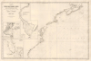
Carte de la Côte des États-Unis Comprise entre la Nouvelle-Ecosse et la Floride.
Finest mid-19th century French charting of the American East Coast.
- Digital Map Information
- Suitable for large format printing
- File Size: 33.22 MB
- File Type: ZIP / TIFF
- ICC color profile embedded
- Delivered instantly via download link
Finest mid-19th century French charting of the American East Coast.
This is Aimé Robiquet's rare 1853 first-edition separately-issued nautical map of the eastern seaboard of the United States, including the Canadian Maritime Provinces. The map captures French interest and trade with the United States, particularly the southern states, in the decade-long lead-up to the American Civil War (1861 - 1865). American raw materials - cotton, tobacco, and grains - were in high demand in France while French luxury goods were de rigour among the Antebellum elite.A Closer Look
Coverage embraces the eastern coastline of North America from Prince Edward Island, Cape Breton, and Nova Scotia, south past Cape Cod, New York, the Chesapeake, the Outer Banks, and the Georgia coast as far as St. Augustine, Florida. Insets detail New York Harbor, Delaware Bay (as far as Philadelphia), and Florida. The New York inset follows the early work of Ferdinand Hassler and Thomas Gedney of the U.S. Coast Survey. The large Delaware Bay inset also follows Coast Survey efforts. In the Florida inset, Volusia, Tampa, Cap Floride (Miami), Ft. Lauderdale, and Cape Canaveral are named. The inland lakes are also well-mapped. Throughout the chart, there are countless depth soundings, and lighthouses are highlighted in yellow and red.Publication History and Census
This chart was engraved by Louis Antoine and published in Paris in 1853 by Aimé Robiquet. This is the first edition. We are aware of subsequent updates in 1861 (likely in anticipation of the Civil War) and 1871. It is rare, as are all Robiquet charts, the American charts being even more so. We see no cataloged examples of any edition in OCLC and have seen only later editions on the market, and then just twice in the last 25 years.Cartographer
Aimé Robiquet (18xx - 18xx) was a French hydrographer and publisher of nautical charts active in the middle part of the 19th century. Little is known of his life, but he was most active as a chartmaker between 1851 and 1865, with several of his charts being reprinted well into the 1870s. He may have gone to sea in the 1860s, but his is unclear. Robiquet's privately published charts were considered among the finest of their generation. His greatest work is the Atlas Hydrographique, a 75-chart elephant folio nautical atlas published in Paris between 1856 and 1861. His offices were located at Rue Pavée Saint Andre No.2. Paris 1856. Further Details...
Condition
Excellent.