
1945 USAAF Florida, Caribbean Aeronautical Charts and Aerial Photographs, World War II

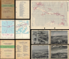
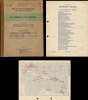
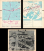
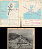
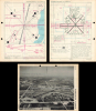
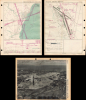
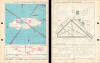
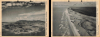
Pilot's Handbook U.S. Army Air Forces Florida to Natal / Photographic Supplement to Pilot's Handbook U.S. Army Air Forces Along Route Florida to Natal.
The Allies' 'Trampoline to Victory'
$1,950.00
Choose a Collection:
This Item
Enquire
The Allies' 'Trampoline to Victory'
This is a rare 1945 restricted / confidential pilot's handbook and photographic supplement prepared by the U.S. Army Air Force's Aeronautical Chart Service. Containing several dozen aeronautical charts and photographs of airfields, it guided pilots along the World War II-era South Atlantic route that ferried supplies from Florida, over the Caribbean, to Brazil, across the Atlantic Ocean, and finally to Allied armies in the field.A Closer Look
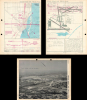
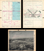
The pilot's handbook contains a key map and twenty-nine double-sided sheets with one side consisting of an aeronautical chart of the approaches to a given airfield and the opposite side being a chart of the airfield itself and its immediate vicinity. Each contains of a diagram of landing procedures and helpful navigational information. The twenty-nine airfields included are:- Amapa, Brazil
- Atkinson Field, British Guiana
- Batista Field, Cuba
- Beane Field, St. Lucia
- Belem (Val De Caes), Brazil
- Benedict Field, St. Croix
- Borinquen Field, Puerto Rico
- Camaguey, Cuba
- Carlsen Field, Trinidad
- Cayenne (Rochambeau), French Guiana
- Ciudad Trujillo (Andrews), Dom. Rep.
- Coolidge Field, Antigua
- Fortaleza (Adjacento), Brazil
- Guantanamo (Mccalla), Cuba
- Homestead Army Air Field, Florida
- Key West (Boca Chica), Florida
- Miami Army Air Field, Florida
- Nassau (Windsor), Bahama Islands
- Natal (Parnamirim), Brazil
- Port Au Prince (Bowen), Haiti
- Roosevelt Roads, Puerto Rico
- Recife (Ibura), Brazil
- San Juan (Isla Grande), Puerto Rico
- Sao Luiz (Tirirical), Brazil
- South Caicos I., Bahama Is.
- Vernam Field, Jamaica
- Waller Field, Trinidad
- West Palm Beach (Morrison Field), Florida
- Zandery Field, Surinam
A supplement to the pilot's handbook contains aerial photographs of the various airfields, noting the date and altitude from which the photograph was taken along with a simple compass. The photographed airfields are:
- Acarahu, Brazil
- Amapa, Brazil
- Atkinson Field, British Guiana
- Batista Field, Cuba
- Beane Field, St. Lucia Island
- Belem (Val De Caes) Brazil
- Benedict Field, St. Croix
- Borinquen, Puerto Rico
- Braganca, Brazil
- Camaguey, Cuba
- Camocim, Brazil
- Cayenne (Rochambeau), French Guiana
- Ciudad Trujillo (Andrews), Dom. Rep.
- Clevelandia, Brazil
- Coolidge Field, Antigua
- Fortaleza (Adjacento), Brazil
- Guantanamo (Mccalla), Cuba
- Homestead, Florida
- Igarape Assu, Brazil
- Joa Pessoa, Brazil
- Key West (Boca Chica), Florida
- Miami Army Air Field, Florida
- Nassau (Windsor), Bahama Islands
- Natal (Parnamirim), Brazil
- Paracuru, Brazil
- Parnaiba (Santos Dumont) Brazil
- Piarco, Trinidad
- Port Au Prince (Bowen), Haiti
- Recife (Ibura), Brazil
- Roosevelt Roads, Puerto Rico
- San Juan (Isla Grande), Puerto Rico
- Sao Luiz (Tirirical), Brazil
- Turi Assu, Brazil
- Vernam Field, Jamaica
- Waller Field, Trinidad
- West Palm Beach (Morrison), Fla.
- Zandery Field, Surinam
Photographs of several check points and terrain are also included:
- Bahama Islands: Great Issac Light, South Caicos Island Landing Strip
- Brazil: Araras Mountains About 8 Miles W of Fortaleza, City of Sao Luiz
- British Guiana: Shell Beach Emergency Landing Strip
- British West Indies: Tobago Island, Crown Point Emergency Landing Strip, Trinidad, Galera Point Emergency Landing Strip and Lighthouse
- Puerto Rico: Cape San Juan
Supplying the War Effort from Florida
Established in 1942, the South Atlantic Wing of the USAAF's Air Transport Command (ATC) served as the vital South Atlantic route during the Second World War. In fact, preparations for such a route began even before the U.S. entered the war, with Pan American Airways, via its subsidiary Panair do Brasil, negotiating with the Brazilian government to upgrade airfields in northern Brazil in preparation for use in the event of a war. Once the U.S. did indeed enter the war, Pan Am and several other airlines carried supplies until the Army Air Force took over the supply runs.Bypassing the severe, unpredictable winter weather of the North Atlantic and avoiding the heavy Axis U-boat presence at sea, this logistical lifeline successfully ferried thousands of aircraft, personnel, and critical lend-lease supplies to global theaters. The transit pipeline typically originated in Florida (primarily out of Morrison Field in West Palm Beach) and hopped through the Caribbean down to northern Brazil, where Natal's Parnamirim Field became famously known as the 'Trampoline to Victory.' From Brazil, transport crews undertook the daunting overwater leap across the South Atlantic, frequently stopping to refuel on the isolated volcanic outpost of Ascension Island, before making landfall in West Africa (such as Accra or Takoradi) and pushing northwards to sustain Allied campaigns in North Africa, the Mediterranean, and the China-Burma-India theater.
The work of the USAAF Aeronautical Chart Service (ACS) was crucial to the safety and precision of these transoceanic flights. Flying over the vast ocean and the poorly mapped, dense expanses of South America and Africa presented immense navigational hazards for relatively inexperienced pilots flying by dead reckoning. To mitigate this, the ACS, working alongside agencies like the U.S. Coast and Geodetic Survey, rapidly compiled aerial photography and geographic data to produce aeronautical charts detailing topography, safe altitudes, and radio frequencies.
Publication History and Census
This map handbook and photographic supplement were prepared by the Headquarters of the Aeronautical Chart Service of the U.S. Army Air Force in 1945. The charts were continually updated and corrected, dated by stamps on the cover of the map handbook, with the latest being September 24, 1945. We are only aware of one other example of this handbook, held by the Museum of Transport and Technology in Auckland, New Zealand.Condition
Very good.
References
Museum of Transport and Technology, Accession number 1970.208.24.