
1970 Florida Keys Star Pictorial Historical Map of Key West


This item has been sold.
Historical Key West, Florida.
Coalescence of the Conch Republic.
Choose a Collection:
This Item
Enquire
Coalescence of the Conch Republic.
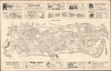
This is a scarce c. 1970 pictorial promotional map of Key West, Florida, published by Florida Keys Star Printing and Publishing. It was produced during a transition period, when Key West was shifting from a rather dated resort destination and military outpost to a magnet for youth counter-culture.A Closer Look
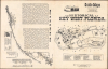
The map displays Key West with streets and major landmarks (military bases, airports, schools, piers, parks, stadiums, and historic sites) labelled throughout. Above and below the map are advertisements for local businesses, as well as an index corresponding to 26 numbered sites throughout the map. The verso includes a pictorial representation of the island with 32 numbered sites noted in an index, along with a highway map of South Florida, table of distances, and text explaining 'What to do in Old Key West.'Historical Context
This map was produced at a time when Key West was becoming known as a destination for hippies, avant-garde artists, 'freaks,' and other counter-cultural types. The partial drawdown of the U.S. military presence on the island and the remnants of aging cigar and shipping industries meant that gorgeous Victorian homes and storefronts could be acquired at cut-rate prices. The area also attracted a significant LGBTQ community and was known for its laissez-faire attitude towards people's lifestyles, including the open use of marijuana. This outlook unsurprisingly clashed with the authorities, most infamously in the 1982 Conch Republic protests, in which the city attempted to secede from the United States (the City Council and Mayor actually declared independence) after the Border Patrol set up disruptive checkpoints along roads, looking for narcotics and illegal immigrants.Publication History and Census
This map was printed by Florida Keys Star Printing and Publishing. It is undated, but is dated to c. 1970 in the OCLC, though the inclusion of both five- and seven-digit phone numbers suggests that it might be somewhat earlier. In any event, the map is only cataloged in the OCLC among the holdings of Cornell University and the Library of Congress.Condition
Very good. Light wear along original fold lines. Text on verso.
References
OCLC 5565469.