
1946 Huntington Town Planning Wall Map of Huntington, Long Island

This item has been sold.
Town of Huntington Suffolk County, N.Y. Street and Highway Map Showing State, County, and Town Roads, State Parkways, Important Landmarks, Parks, Schools, Etc. Street Names Amended April 23, 1946.
Internal-Use Government Plan of Huntington.
Choose a Collection:
- Digital Map Information
- Suitable for large format printing
- Full resolution TIFF file
- ICC color profile embedded
- Delivered instantly via download link
This Item
Enquire
Internal-Use Government Plan of Huntington.
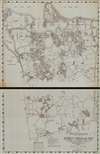
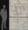
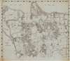
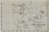
This is an enormous 1946/48 official Town Planning Board map of Huntington, Long Island, New York. The map captures official efforts at zoning and redistricting to accommodate Long Island's post-World War II (1939 - 1945) population boom.A Closer Look
Printed on two sheets, likely from an original surveyor's manuscript, coverage includes Huntington and the surrounding area from Long Island Sound south to the boundary between Huntington and Babylon, and from Cold Spring Harbor and the Township of Oyster Bay to the boundary between Huntington and the towns of Islip and Smithtown. Highways and streets are labeled throughout, including neighborhood streets in Huntington Village, Huntington Station, Northport, and East Northport. Churches and schools, Huntington Hospital, a Veterans' Hospital, and other municipal and civic service buildings are identified. The Port Jefferson Branch of the Long Island Railroad cuts through Huntington, and the station is labeled.Historical Context
In 1946, Huntington, Long Island, stood at the threshold of significant suburban transformation, as town leaders began responding to mounting post-World War II housing demand and returning veterans seeking permanent residence. While the community still retained its historic village core along Main Street and the harbor, planning efforts increasingly focused on residential subdivision, roadway improvements, and expanded municipal services. Zoning regulations, which had been introduced earlier in the 20th century, became more consequential as agricultural land and large estates were gradually subdivided for single-family housing. Town officials worked to improve infrastructure to accommodate anticipated population growth, while balancing development with preservation of the North Shore's established character. Although large-scale mass developments like Levittown would soon dominate Long Island's planning landscape after 1947, Huntington in 1946 was actively laying the groundwork for its evolution from a semi-rural township into a structured suburban community shaped by coordinated land-use planning and expanding transportation access.Publication History and Census
This map was created for and published by the Huntington Town Planning Board, with street names updated to May 1, 1946. It was made for internal city and township administrative use. This is the only known example of the present edition of this map. We note a cataloged example of a later edition in OCLC that is part of the collection at Pennsylvania State University that has been 'brought up to date, April 27, 1948'.Condition
Very good. Four areas of residue on recto (front) from strange adhesive we removed.