
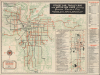
1944 Map of Public Transit Lines, Kansas City, Missouri

This item has been sold.
Street Car, Trolley Bus and Motor Bus Lines Serving Greater Kansas City.
World War II-Era Kansas City.
Choose a Collection:
- Digital Map Information
- Suitable for large format printing
- Full resolution TIFF file
- ICC color profile embedded
- Delivered instantly via download link
This Item
Enquire
World War II-Era Kansas City.
This is a visually striking 1944 map of Kansas City and environs, produced by the Kansas City Public Service Company. It focuses on the public transportation system of Greater Kansas City, capturing it in the World War II-era transition from streetcars to automobiles.A Closer Look
The sheet includes two maps, one at left being a map of the wider Kansas City metropolitan area as far as Kansas City, Kansas, Independence, and Dodson, with streetcar, (motor) bus, and trolley bus lines. Aside from transportation lines, major streets, airports, cemeteries, industrial districts, golf courses, and parks are recorded. The smaller inset map at right covers downtown Kansas City, tracing public transportation lines and listing them to the left. The main map is surrounded by a grid corresponding to indexes at right and on the verso, covering the various transportation lines, hotels, schools, hospitals, and points of interest. The verso also includes extensive text on service men's clubs and centers, reflecting the wartime environment. The large number of factories engaged in wartime production and nearby army bases made the city a crossroads for members of the military.The Kansas City Public Service Company
The Kansas City Public Service Company was established in 1919 as the successor to several smaller street railway and utility firms that had operated in Kansas City, Missouri, since the late 19th century. It was part of the nationwide movement in the early 20th century toward consolidating fragmented transit systems into unified, modernized companies capable of handling growing urban populations. The company operated the city's extensive streetcar network, which by the 1920s comprised dozens of routes connecting downtown Kansas City with its rapidly expanding residential districts. In addition to streetcars, the company was involved in electric power generation and distribution, reflecting the era's tendency for public service corporations to control multiple essential urban utilities under a single corporate umbrella. However, as with other cities, the rise of the automobile and suburban development led to declining ridership on streetcars, and the company began converting its routes to bus service in the 1940s. By 1957, the last streetcars in Kansas City were retired, marking the end of an era in the city's public transit history. Eventually, the Kansas City Public Service Company was reorganized and sold the city's newly formed Kansas City Area Transportation Authority (KCATA) in 1969.Publication History and Census
This map was prepared in January 1944 by the Kansas City Public Service Company in conjunction with the Convention and Visitors Bureau of the Kansas City Chamber of Commerce. Several editions of a map with this title are cataloged among the holdings of 7 institutions in the OCLC, but the present edition is only noted among the holdings of the University of Missouri-Kansas City and Yale University; the Kansas City Public Library also holds an example in its General Map Collection.Condition
Very good. Light wear along original fold lines. Slight loss at a few fold intersections. Text on verso.
References
OCLC 54655570.