
1919 / 1955 Conservation Commission Map of Lake George, New York, and Environs

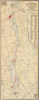

Map of Lake George Showing Islands of the State Forest Preserve.
Queen of American Lakes.
$400.00
Choose a Collection:
This Item
Enquire
Queen of American Lakes.
This is a 1919 / 1955 Conservation Department of the State of New York map of Lake George and environs. Beginning with the arrival of railroad connections to major East Coast cities in the late 19th century, the lake became a favorite summertime destination for vacationers.A Closer Look
The map depicts Lake George from the town of Lake George to Ticonderoga and from Bolton and Hague Counties to Dresden, Putnam, and Whitehall Counties. Topography lines are present, indicating the elevation of the surrounding terrain. Numerous towns around Lake George are labeled, as are several smaller lakes and Lake Champlain, as well as roads, railroad lines, and historical ruins. 119 'state islands' in Lake George are depicted in red, with a corresponding numerical list along the right border.Two 'advertisements' appear. One, in the upper left corner, states 'Broken Game Laws: Less Game, Sport, Business. Everybody loses. Your personal influence counts. Help prevent violations.' The other, in the lower right corner, is a reminder to help prevent forest fires, reminding people to extinguish matches, cigars, and cigarettes and to put out their campfire before leaving.
The 'Queen of American Lakes'
Originally known to most Americans as a battleground in the French and Indian War (1754 - 1763) and American Revolutionary War (1775 - 1783), Lake George became a major resort destination in the late 19th century when it was connected by railway (beginning with the Delaware and Hudson in 1882) to larger networks reaching major cities. Aside from offering a cool retreat from sweltering summers in the city, the romance of the lake was heightened by American landscape painters who idealized the wider Adirondack region. Just after the railroad, opulent grand hotels emerged alongside majestic lake steamboats, establishing the region as an exclusive high-society retreat. By the mid-20th century, the post-WWII automobile boom and expanded highway access democratized the lake's resort culture, transforming it from an elite hideaway into a quintessential American family vacation hub.Publication History and Census
This map was originally prepared by A. S. Hopkins and Albert T. Davis of the Conservation Commission of the State of New York in 1919 and was updated regularly thereafter; the present example is a 1955 edition. The OCLC records various editions at eight institutions, but the present edition does not appear to be cataloged at any institution.Condition
Very good. Marginal mends, recornered with minimal loss. Reinforced.
References
OCLC 55647275 (all editions).