
1949 Thomas Bros. Map of Los Angeles, California and Nearby Cities

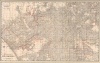
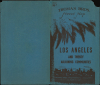
City Street Map of Los Angeles / Thomas Bros. Street Map Los Angeles and Twenty Adjoining Communities.
L.A.'s Postwar Building Boom.
- Digital Map Information
- Suitable for large format printing
- Full resolution TIFF file
- ICC color profile embedded
- Delivered instantly via download link
L.A.'s Postwar Building Boom.
This is a large-format c. 1949 Thomas Brothers street map of Los Angeles and nearby cities in Southern California. It presents the area as the last undeveloped portions of L.A.'s urban sprawl were being filled in, resulting in the seemingly infinite sea of concrete familiar to us today.A Closer Look
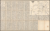
The map covers the central part of the City of Los Angeles; that is, minus the canyons and San Fernando Valley to the north, Pacific Palisades to the west, and the Strip or 'Shoestring' in the south leading to the Harbor of Los Angeles. Adjacent cities and communities are also included, in part or whole, such as Santa Monica, Beverly Hills, West Hollywood, Culver City, Inglewood, Vernon, and Huntington Park, while neighborhoods of Los Angeles, such as Hollywood, Venice, and Boyle Heights, are similarly labeled. Streets are named throughout, and are also listed in an alphabetical index on the verso, which corresponds to a grid surrounding the map and is included in red overprint on a crosshairs running through the center of the map. Parks, playgrounds, golf courses, waterways, railways, airports, schools, hospitals, and other features are indicated throughout. The verso also contains a transit map, listing both streetcar and motor coach lines, reflecting the transition away from the once-dominant electric lines towards automobiles.Historical Context
This map presents Los Angeles and its neighboring cities at a time when they were growing rapidly, driven by wartime and postwar migration, particularly of military personnel who had passed through Southern California during their service and decided it was a nice place to live. The GI Bill greatly facilitated this suburban sprawl, incentivizing developers to construct entire neighborhoods quickly. The result was that the few areas of Los Angeles that had not already been developed became so now, with space set aside for expected amenities, especially golf courses. Even the canyons, hills, and mountains to the northwest of downtown and sporadically elsewhere (such as Baldwin Hills) became populated around this time, mostly by wealthier residents who sought escape from the bustle of the low-lying lands below.At this point, L.A. was only in the preliminary stages of the highway building boom that would define it in the coming years. The Arroyo Seco Parkway and Hollywood Parkway were already extant, forming prototypes for later essential arteries, such as the San Diego Freeway through the Sepulveda Pass (now I-405). As mentioned above, the last remnants of the streetcar and interurban electric car (Pacific Electric) system were still in operation, but the dominance of the automobile was becoming increasingly evident, challenging urban planners to address the city's already very severe traffic problem (refer, for example, to our listing LATraffic-highwayscommittee-1924).
Publication History and Census
This map was prepared by the California cartographic powerhouse Thomas Brothers in 1949, suggested by the date of the transit map on the verso (February 1, 1949) and confirmed by the Library of Congress' Catalog of Copyright Entries for that year. It was published in several editions, sometimes with slightly different titles or arrangements (see, for comparison, our earlier listing LosAngeles-thomasbros-1944). This edition of the map is only noted among the institutional holdings of the University of California, Berkeley, and the University of Minnesota, Twin Cities.Cartographer
Thomas Brothers (1915 – 1999) was a prominent California-based English-American publisher specializing in maps and guidebooks. Founded in Oakland in 1915 by George Copeland Thomas, Guilbert Thomas, and Leonard Thomas, the company began modestly, selling maps of movie stars' homes from a Hollywood street corner, before developing into a major cartographic and guidebook publisher. Following George Thomas's death in 1955, his widow retained attorney Warren Wilson to organize the company's affairs. When none of the Thomas heirs expressed interest in continuing the business, Wilson and accountant Tom Tripodic purchased it, preserving the Thomas Brothers tradition while pursuing a new direction and eventually relocating the company's headquarters from San Francisco to Irvine, California. The firm prospered under Tripodic, growing to more than 200 employees and dominating the West Coast map market. Rand McNally acquired Thomas Brothers in 1999, laid off many of its experienced cartographers and employees in 2003, and closed the company's remaining California operations in 2009. Further Details...
Condition
Good. Wear along original fold lines. Verso repairs to fold separations and at fold intersections. 2 closed 4-inch tears within printed image professionally repaired on verso. Closed edge tears professionally repaired on verso. Transit Map of Los Angeles and alphabetical street index on verso. Very small areas of loss along original fold lines.
References
OCLC 25613762.