
1883 Post Office Dept. Map Wall Map of New England

This item has been sold.
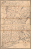
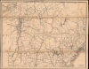
Post Route Map of the States of New Hampshire, Vermont, Massachusetts, Rhode Island, Connecticut, and Parts of New York and Maine.
Massive Late 19th Century Postal Map of New England
- Digital Map Information
- Suitable for large format printing
- Full resolution TIFF file
- ICC color profile embedded
- Delivered instantly via download link
Massive Late 19th Century Postal Map of New England
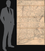
This is a large (62.5 x 39 in) two-sheet 1883 map of the New England states issued for internal use by the United States Postal Service. A highly detailed map, it is a testament to the remarkable reach of the Postal Service into even the most rural corners of New England. The map is dissected into two panels that fold neatly into an elegantly tooled leather slipcase.A Closer Look
The map covers the entirety of New Hampshire, Vermont, Massachusetts, and Connecticut, with portions of New York, Maine, and Quebec (as explained in a note at the bottom-right of the northern sheet, the size and remoteness of northern Maine led to its being relegated to a separate, special map). County lines are traced in red and cities and towns are labeled throughout. As might be expected from an operation as large and complex as the United States Postal Service, the map offers impressive detail, noting roads, railroads, and maritime routes throughout, as well as mileage from town to town. A table in the lower-right of the southern sheet explains the color-coding used to indicate postal routes and frequency of delivery, from once a week to six times a week. In the upper-right of the southern sheet is a table of distances of postal routes and an inset map of the area around Boston. Longitude is measured from Washington, D.C.Maps of the Postal Service
From its earliest days, the Department of the Post Office was one of the largest and most hard-working elements of the United States federal government. Its mandate to deliver mail to every part of the country required the best possible maps, which entailed employing the best cartographers, topographers, surveyors, and engravers. Postal mapmaking began with Abraham Bradley, who published maps from 1796 to about 1825. Afterwards, the work was taken up by H. W. Swift (1830 - 1833), then David H. Burr (1803 - 1875), who became the department's first official 'Topographer.' Burr was followed in this position by his brother Henry A. Burr (1809 - March 1863) who held that position until 1862. He was followed in 1862 by Walter Lamb Nicholson, who remained as Topographer of the Post Office until 1882, when he was replaced by Charles Roeser Jr. in a move filled with political intrigue tied to the campaign of civil service reform by stalwart Republicans. When Roeser's champion, Postmaster General Timothy Howe, died in 1883, he was replaced by Walter Gresham, who promptly brought Nicholson back as Topographer in 1884, a post he held until his retirement in 1887. Roser's tenure as Topographer was brief, but his reform measures, such as adopting photolithography to save time and money on printing maps, were adopted and helped professionalize the Topographer's section of the Postal Service.Some Insight into the Post Office Topographer's Office
The following description of the Postal Topographer's work is drawn from Arthur Hecht's Records of the Columbia Historical Society, vol 50, pages 95 - 104,The work of the Topographer's Office consisted of projecting and compiling the original drawings of postal route maps of the general edition to replace old, worn-out, and inaccurate maps, and of tracing and lettering them for photolithography, preparing special drawings of enlarged sub-maps of the environs of the principal cities, making sample diagrams of special editions of states and territories for the Railway Mail Service to exhibit the different lines and their connecting side mail routes, and testing new photolithographic maps received from the contract.
Publication History and Census
This map was prepared in 1883 by Charles Richard Roeser, recently appointed as the Postal Service's Chief Topographer. Unsurprisingly, the map required constant updating and revision, so there are multiple states and editions published from 1866 to about 1900. While the official nature of the map means that it is well represented in institutional and government collections (we note examples of this edition at the University of Chicago and Boston Public Library), it is very scarce to the private market.Cartographer
Charles 'Karl' Richard Roeser, Jr. (December 15, 1842 - June 23, 1893) was a Prussian-American surveyor and draftsman working with the U.S. General Land Office in the second half of the 19th century. Roeser was born in Merseburg, Saalekreis, Saxony-Anhalt, Germany, but emigrated to the United States as a child with his family, settling in Wisconsin. In 1857-61 he took a degree in engineering from Lawrence University, Wisconsin, then went on to take a degree in law from Columbia. Shortly after the American Civil War (1861 - 1865) he entered public service as the Chief Draftsman of the General Land Office. He issued an 1875 map of the United States and an 1876 Centennial atlas of the United States, the Geographical and political atlas of the states and territories of the United States of America. He transferred to the Topographer's Office under Postmaster General Howe in 1882 with the mission to fully reorganize and modernize that department's mapping resources. His tenure was brief, as political infighting around civil service reform caused him to be sacked and replaced by his predecessor, Walter Nicholson. Roeser nevertheless instituted several important reforms that helped professionalize the Topographer's office and improve its efficiency, keeping with his civil service reform beliefs. Further Details...
Condition
Very good. Dissected and mounted on linen in two unjoined sheets. Wear to linen with a few splits.
References
OCLC 55093104, 798261033. Blevins, C., 'The Postal West: Spatial Integration And The American West, 1865-1902,' (Ph.D. Dissertation, Stanford University) 2015, pp. 116 - 118.